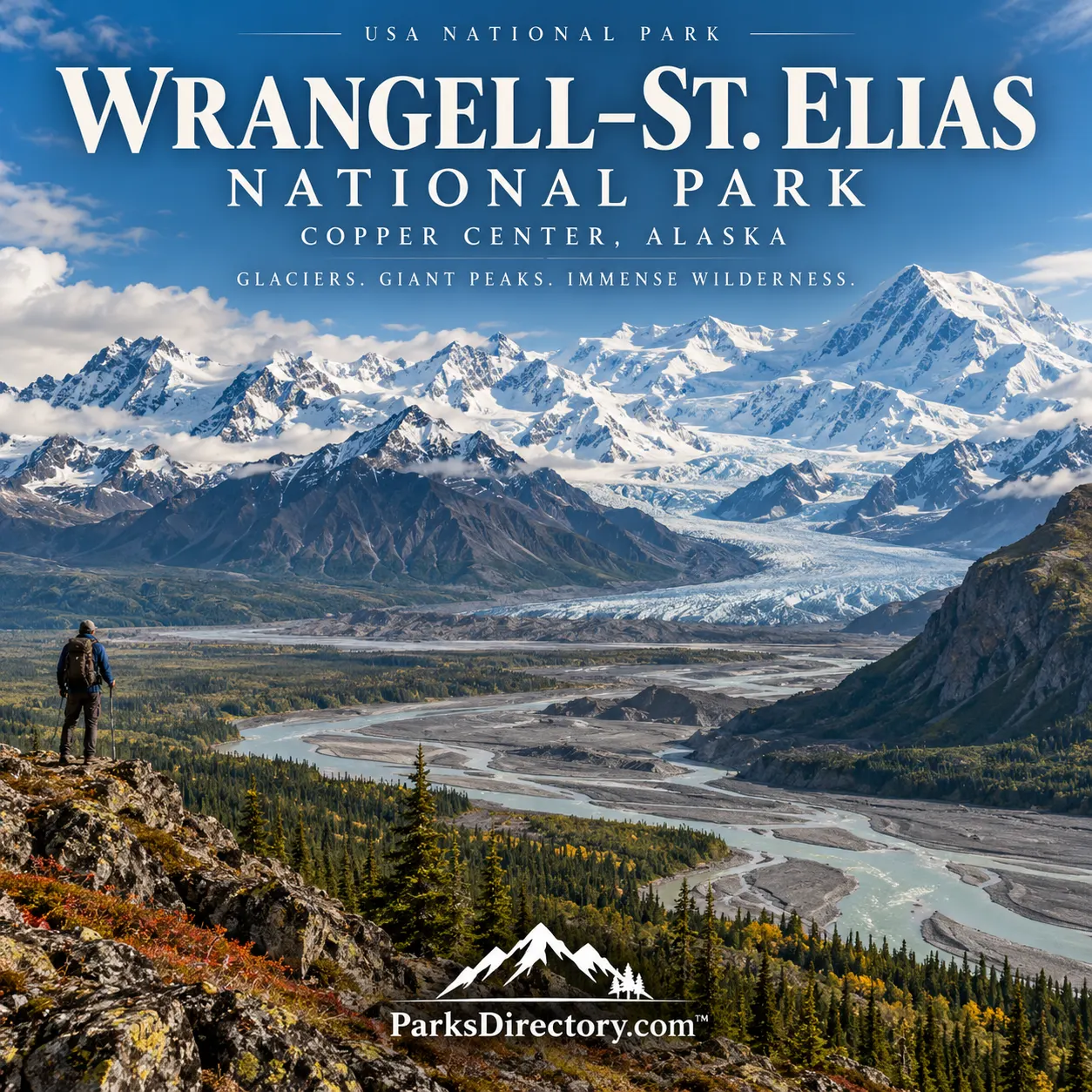
Wrangell–St. Elias National Park: Summary, History, and Alaska on a Continental Scale
ParksDirectory.com™ | National Park Summary & History
Mountains, glaciers, and a lived-in wilderness
Wrangell–St. Elias National Park and Preserve protects an immense sweep of Alaska, where towering mountain ranges connect inland valleys with the Gulf of Alaska. Glaciers feed braided rivers, wildlife moves across broad habitats, and historic mining buildings stand beneath peaks that dwarf them. Yet this is not an empty landscape. People continue to live within and around the protected area, and its conservation framework recognizes long-established relationships with the land.[1]
Its appeal is consequently larger than a single famous overlook. Wrangell–St. Elias invites an understanding of scale: geological processes, community histories, and ecosystems operating across distances that are difficult to grasp from a map alone.[2]
Location and size: park and preserve together
The protected area lies east of Anchorage, adjoining Canada and extending from Alaska’s interior toward its southern coast. Copper Center is an important administrative and visitor-information gateway. Other approaches reveal different regions rather than leading to one central attraction.[1:1][2:1]
The National Park Service’s geodiversity atlas lists 13,175,791 acres, approximately 20,587 square miles, for Wrangell–St. Elias National Park and Preserve combined. This is the largest unit administered by the National Park Service. The combined figure should not be presented as acreage belonging solely to the national-park portion: the adjoining national preserve is a distinct designation within the larger managed landscape.[2:2]
Preserves are managed similarly to parks but allow certain additional uses, including regulated sport hunting. Boundaries, land ownership, and the conditions attached to different activities therefore matter here in ways that a simple scenic map cannot fully explain.[3]
Establishment: 1978 protection, 1980 park designation
President Jimmy Carter proclaimed Wrangell–St. Elias National Monument on December 1, 1978. The national park and preserve followed on December 2, 1980, through the Alaska National Interest Lands Conservation Act, commonly called ANILCA.[2:3][4]
The legislation emerged from years of debate about Alaska Native land claims, conservation, development, transportation, and subsistence. It did more than draw a boundary around outstanding scenery. It established a framework intended to conserve natural and cultural resources while recognizing particular continuing uses. That history explains why the park and preserve are neither an uninhabited reserve nor a landscape governed by a single uniform set of conditions.[4:1]
Indigenous connections and continuing communities
Ahtna people have longstanding ties to the Copper River region, including hunting, fishing, gathering, and knowledge passed between generations. The coastal region also connects with Tlingit history, particularly around Yakutat. These relationships precede federal designation and remain part of the area’s identity.[1:2][5]
The National Park Service’s cultural program documents archaeological places, historic buildings, collections, and landscapes important to contemporary communities. Its interpretation includes people such as Ahtna elder Katie John, whose life is associated with the defense of Alaska Native rights. This perspective helps replace the misleading idea that wilderness means an absence of human history.[6][7]
Subsistence recognition is especially important. ANILCA acknowledges the cultural and economic significance of harvesting wild resources for eligible rural residents. The resulting management responsibilities connect environmental protection with community life, rather than treating them as unrelated subjects.[8]
Four mountain ranges and active geology
Four major ranges meet within the wider park-and-preserve landscape: the Wrangell, St. Elias, Chugach, and eastern Alaska ranges. Mount St. Elias rises to 18,008 feet near the international boundary, while the Wrangell Mountains include volcanic peaks. The combination produces an extraordinary concentration of steep relief, snowfields, and high summits.[5:1]
These mountains reflect a complicated geological history. Different pieces of Earth’s crust were assembled through plate movements, and faulting, uplift, and volcanism continued to reshape them. The scenery is therefore not simply the remains of a finished mountain-building episode. It records active relationships among crustal movement, volcanic heat, weather, ice, and erosion.[9]
Glaciers that shape the entire landscape
Glaciers are among the park’s defining features. The Bagley Icefield, Nabesna Glacier, Hubbard Glacier, and Malaspina Glacier demonstrate different forms of glacial terrain. Malaspina, also known by the Tlingit name Sít’ Tlein, spreads outward at the mountain front as a vast piedmont glacier. Hubbard reaches the sea, where the movement and loss of ice involve interactions with water as well as climate.[10]
The glaciers also shape the rivers. Meltwater transports fine sediment, helping create shifting braided channels. Near Kennecott, the debris-covered Kennicott Glacier shows why glacier ice is not always a clean blue-white surface: rock and sediment can mantle substantial ice beneath. These features connect distant summits with valley-floor processes that visitors can more readily observe.[10:1]
Kennecott and the copper-mining era
The Kennecott Mines National Historic Landmark preserves one of the area’s most remarkable human stories. Copper production between 1911 and 1938 linked remote mountain deposits to industrial markets through mines, aerial tramways, a concentration mill, and a railroad connection to the coast.[11]
Kennecott was a functioning company town, with homes and services supporting workers and families. Its surviving buildings reveal both technological ambition and the practical demands of daily life. The great mill is only one part of that larger system. Declining ore quality and rising costs contributed to the operation’s closure, leaving structures that later required substantial preservation work.[11:1]
The National Park Service acquired important buildings and lands in 1998. Stabilization and interpretation now make the mining landscape a place to examine labor, investment, engineering, and the environmental consequences of resource extraction.[11:2]
Distinct gateways and notable landscapes
The McCarthy Road and Kennecott area offers a particularly strong connection between settlement history and glacier scenery. The Nabesna Road approaches a different, northern part of the protected landscape, where mountains and interior valleys create another impression of its enormous extent.[12][13]
These are separate introductions, not pieces of an easy loop through the whole park. Much of Wrangell–St. Elias lies far beyond its limited roads. That geography is central to its character: a traveler can encounter one accessible valley while remaining aware that immense icefields, mountains, and coastlines continue well beyond it.[5:2]
Wildlife adds another layer. Dall sheep occupy rugged mountain terrain, while moose favor wetter lowlands. Caribou, mountain goats, wolves, and bears illustrate the diversity of habitats contained within the broader protected area.[14]
Why the park matters
Wrangell–St. Elias belongs to a transboundary World Heritage landscape that also includes Kluane, Glacier Bay, and Tatshenshini-Alsek. That recognition emphasizes ecological and geological relationships extending beyond national borders.[15]
Its importance rests not only on immense acreage or dramatic summits, but on the survival of connected systems and layered histories. Here, conservation encompasses glaciers, wildlife, archaeological places, industrial remains, and continuing communities. Together they make Wrangell–St. Elias one of the most expansive and revealing landscapes in America’s national-park system.[1:3][6:1]
Sources
Research checked September 6, 2026. The acreage and square-mile figures refer to the combined national park and national preserve, not the park portion alone.
National Park Service, “Wrangell–St. Elias Park Management.” https://www.nps.gov/wrst/learn/management/index.htm ↩︎ ↩︎ ↩︎ ↩︎
National Park Service, “NPS Geodiversity Atlas—Wrangell–St. Elias National Park, Alaska.” https://www.nps.gov/articles/nps-geodiversity-atlas-wrangell-st-elias-national-park-alaska.htm ↩︎ ↩︎ ↩︎ ↩︎
National Park Service, “What Is a Park and Preserve?” https://www.nps.gov/wrst/learn/management/park-and-preserve.htm ↩︎
National Park Service, “Alaska National Interest Lands Conservation Act: Creation of Wrangell–St. Elias.” https://www.nps.gov/wrst/learn/management/alaska-national-interest-lands-conservation-act.htm ↩︎ ↩︎
National Park Service, “What’s So Special About Wrangell–St. Elias.” https://www.nps.gov/wrst/whats-so-special.htm ↩︎ ↩︎ ↩︎
National Park Service, “History & Culture.” https://www.nps.gov/wrst/learn/historyculture/index.htm ↩︎ ↩︎
National Park Service, “People.” https://www.nps.gov/wrst/learn/historyculture/people.htm ↩︎
National Park Service, “Wrangell–St. Elias National Park and Preserve,” Alaska subsistence overview. https://www.nps.gov/subjects/alaskasubsistence3/wrangell.htm ↩︎
National Park Service, “Geology.” https://www.nps.gov/wrst/learn/nature/geology.htm ↩︎
National Park Service, “Glaciers.” https://www.nps.gov/wrst/learn/nature/glaciers.htm ↩︎ ↩︎
National Park Service, “Kennecott Mines National Historic Landmark.” https://www.nps.gov/wrst/learn/historyculture/kennecott-mines-national-historic-landmark.htm ↩︎ ↩︎ ↩︎
National Park Service, “McCarthy Road & Kennecott Area.” https://www.nps.gov/wrst/planyourvisit/mccarthy-road-and-kennecott-area.htm ↩︎
National Park Service, “Nabesna Road.” https://www.nps.gov/wrst/planyourvisit/nabesna-road.htm ↩︎
National Park Service, “Mammals.” https://www.nps.gov/wrst/learn/nature/mammals.htm ↩︎
National Park Service, “World Heritage Site.” https://www.nps.gov/wrst/world-heritage.htm ↩︎