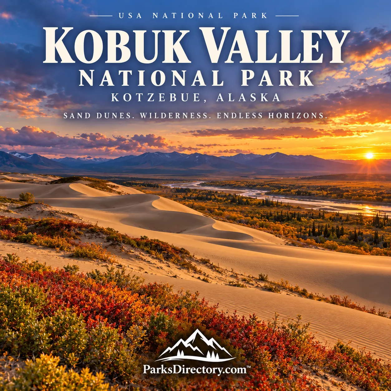
Kobuk Valley National Park: Arctic Sand Dunes and an Ancient River Corridor
ParksDirectory.com™ | National Park Summary & History
An unexpected Arctic landscape
Kobuk Valley National Park challenges the idea that Arctic scenery must consist entirely of ice or treeless tundra. Here, golden sand dunes rise beside boreal forest, a broad river crosses a mountain basin, and caribou travel through a landscape with a deep human history. The park’s most surprising feature—the sand—is only one element of a connected river, wildlife, and cultural system.[1]
The park lies north of the Arctic Circle in northwestern Alaska, within the Northwest Arctic Borough. Kotzebue is its administrative and aviation gateway, not the location of the dunes themselves. The protected area encompasses approximately 1,750,716 acres, or 2,736 square miles, along the middle Kobuk River and surrounding country. Its northern boundary adjoins Noatak National Preserve, placing it within a much larger protected Arctic landscape.[1:1]
President Jimmy Carter proclaimed Kobuk Valley National Monument on December 1, 1978. The Alaska National Interest Lands Conservation Act established Kobuk Valley National Park on December 2, 1980. Its purposes explicitly connect natural features, archaeological resources, wildlife migration, and subsistence traditions.[1:2][2]
Why there are sand dunes above the Arctic Circle
The Great Kobuk Sand Dunes are a legacy of glacial environments rather than evidence of a hot-climate desert. Glaciers ground rock into finer material; sediment was transported into the valley, and wind redistributed it into dunes. As conditions changed after the Ice Age, vegetation reclaimed much of the formerly open sand, leaving the active fields visible today.[3]
The largest field, the Great Kobuk Sand Dunes, covers roughly 25 square miles. The Little Kobuk and Hunt River dunes provide additional examples of the same regional story. Their pale, shifting surfaces contrast strongly with the surrounding plants and dark conifers. From the ground, this contrast can make the dunes appear almost detached from the Arctic, but their origin belongs directly to its glacial history.[1:3][3:1]
A river that organizes the landscape
The Kobuk River is the park’s central corridor. Its water, banks, tributaries, and floodplain connect habitats across the valley and provide routes used by both animals and people. The river should not be understood simply as a scenic line beneath an aircraft. It is an organizing feature around which travel, food gathering, and settlement have long developed.[2:1]
A river-centered view also makes the park’s boundaries easier to understand. Protecting a dune field alone would not protect fish habitat, migration crossings, or the cultural places associated with the river. The national park preserves a broad section of an interconnected valley, allowing natural processes and long-established human relationships to be considered together.[2:2][4]
Paatitaaq: the living history of Onion Portage
Onion Portage, known as Paatitaaq, is one of the park’s most important cultural places. Its name refers to wild onions and to a portage that shortens travel around a long river bend. For thousands of years, people gathered here to harvest caribou crossing the Kobuk River. The location’s usefulness was not accidental: geography created a recurring opportunity within the animals’ wider migration.[5]
The archaeological record preserves layers of camps, tools, house remains, and other evidence of human activity. These deposits allow researchers to investigate changing ways of life over millennia. National Park Service summaries differ in their exact chronological estimates, but the site’s documented significance securely extends back at least 8,000 years. That depth makes it a major source for understanding the human history of Arctic Alaska.[6]
Onion Portage is not merely a place where traditions once occurred. Descendants of earlier inhabitants continue to use the wider area, and local knowledge remains essential to its meaning. Archaeological interpretation and living cultural practice illuminate different aspects of the same landscape; neither should erase the other.[5:1][6:1]
The people of the Kobuk Valley
The park lies within the traditional homeland of Iñupiaq communities, including the KuvuNmiut. Fishing, hunting, gathering, and the sharing of knowledge connect residents with the valley’s seasonal resources. Fish such as sheefish and salmon are important alongside caribou, demonstrating that subsistence life depends on a range of foods and habitats rather than a single iconic species.[7]
The 1980 conservation legislation recognized subsistence as part of the protected landscape’s continuing life. This differs from the simplified idea that a national park must exclude all longstanding uses by local people. The park’s management framework includes a Subsistence Resource Commission, giving local users a formal role in discussions about resources and their future.[2:3][7:1]
Caribou and a landscape larger than the park
Caribou migrations are among Kobuk Valley’s defining natural phenomena. Tracks across the dunes and crossings along the river reveal animals moving through a seasonal landscape rather than living permanently around one viewing site. Their routes connect feeding grounds and other resources over distances far beyond the national-park boundary.[2:4][3:2]
That mobility makes a fixed herd count or a guaranteed viewing promise inappropriate for a general park history. The significant feature is the migration system and the habitat that supports it. Conserving the valley helps protect an important portion of that system, while the animals’ larger movements demonstrate why coordination beyond any single park is necessary.[4:1]
Archaeology and the work of Louis Giddings
Archaeologist J. Louis Giddings played an important role in investigating Onion Portage. His work sought well-stratified evidence that could clarify sequences of cultural change in the Arctic. Returning to the site in 1961, he and his colleagues recognized the importance of deposits accumulated through repeated occupation.[8]
The value of the site lies not only in individual artifacts but in their relationships to one another and to the layers containing them. An object removed without documentation loses much of its ability to explain the past. This is why archaeological protection is fundamental to the park: preserving context allows future researchers and communities to ask questions that a collection of isolated objects could never answer.[6:2][8:1]
What makes a visit distinctive
The Great Kobuk Sand Dunes offer the park’s most immediately recognizable scenery. Walking across open sand toward forest and distant mountains reveals an unusual combination of forms and environments. River travel provides another perspective, following a route with thousands of years of human significance. Neither experience resembles a conventional national-park drive from overlook to overlook.[9]
Kobuk Valley is most meaningful when the dunes, river, caribou, and cultural sites are understood as connected. Its protection preserves a landscape where ecological movement and human history remain active rather than merely commemorated. The result is an Arctic national park defined as much by continuity and adaptation as by remoteness.[4:2][7:2]
Sources
Research reviewed September 6, 2026. Acreage follows the NPS geodiversity overview; square miles are rounded conversions. Onion Portage’s chronology is conservatively described because NPS summaries use estimates from 8,000 to 10,000 years. No current herd population is asserted.
National Park Service, “NPS Geodiversity Atlas—Kobuk Valley National Park, Alaska.” https://www.nps.gov/articles/nps-geodiversity-atlas-kobuk-valley-national-park-alaska.htm ↩︎ ↩︎ ↩︎ ↩︎
National Park Service, “Kobuk Valley National Park—Alaska Subsistence.” https://www.nps.gov/subjects/alaskasubsistence3/kobuk-valley.htm ↩︎ ↩︎ ↩︎ ↩︎ ↩︎
National Park Service, “Great Kobuk Sand Dunes.” https://www.nps.gov/kova/learn/nature/great-kobuk-sand-dunes.htm ↩︎ ↩︎ ↩︎
National Park Service, “Kobuk Valley National Park Wilderness Character.” https://www.nps.gov/articles/kovawildernesscharacter.htm ↩︎ ↩︎ ↩︎
National Park Service, “Paatitaaq-Onion Portage.” https://www.nps.gov/kova/learn/historyculture/paatitaaq-onion-portage.htm ↩︎ ↩︎
National Park Service, “Onion Portage Archeological District National Historic Landmark.” https://www.nps.gov/places/onion-portage-archeological-district.htm ↩︎ ↩︎ ↩︎
National Park Service, “Alaska Native Heritage at Kobuk Valley National Park.” https://www.nps.gov/locations/alaska/native-heritage-kova.htm ↩︎ ↩︎ ↩︎
National Park Service, “Louis Giddings.” https://www.nps.gov/kova/learn/historyculture/giddings.htm ↩︎ ↩︎
National Park Service, “National Park Getaway: Kobuk Valley.” https://www.nps.gov/articles/getaway-kova.htm ↩︎