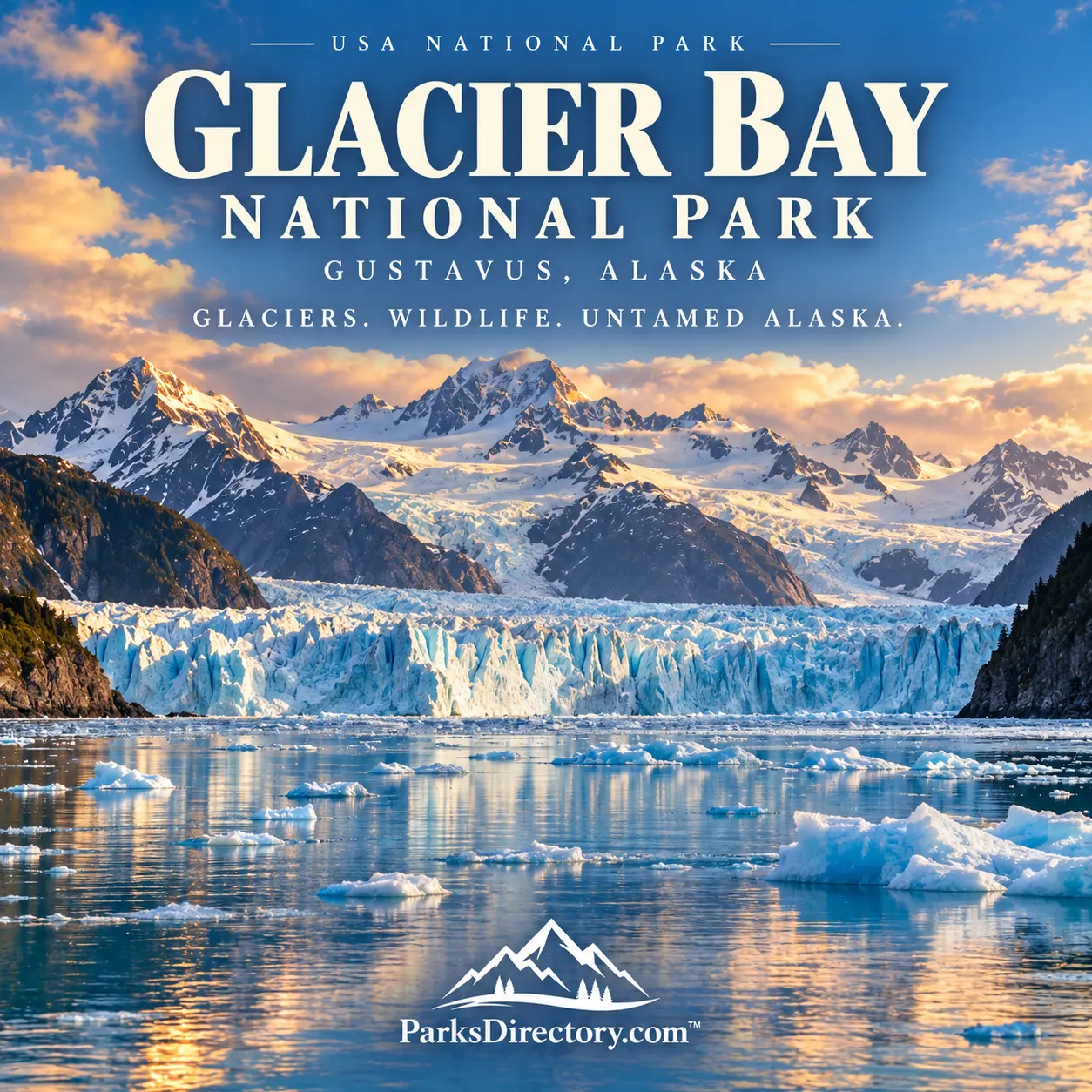
Glacier Bay National Park

Gustavus, Alaska · Alaska outdoor places

Glacier Bay National Park

History

Glacier Bay National Park: Ice, Living Homelands, and a Landscape Becoming New

ParksDirectory.com™ | National Park Summary & History

Location, size, and establishment

Glacier Bay National Park and Preserve lies in southeastern Alaska, where marine inlets reach into mountains and icefields northwest of Juneau. Gustavus is the nearby community associated with the park’s headquarters at Bartlett Cove. This is a coastal Alaskan park, entirely separate from Glacier National Park in Montana.[1]

The NPS fact sheet reports 3,222,434 acres for the national park and 58,406 acres for the national preserve. Together they total 3,280,840 acres, approximately 5,126 square miles. The combined figure includes extensive marine waters as well as forests, mountains, and glaciers. It should not be confused with the much larger international World Heritage property of which Glacier Bay forms one part.[1:1]

Glacier Bay became a national monument on February 26, 1925. Its present designation as a national park and preserve dates to December 2, 1980, under ANILCA. These two milestones connect an early scientific conservation campaign with the broader protection of Alaska’s landscapes in the late twentieth century.[2]

A living Lingít homeland

Glacier Bay is the ancestral homeland of Huna and Yakutat Lingít, also commonly written Tlingit. Their relationships with its lands and waters long predate scientific surveys, tourist voyages, or federal boundaries. Place names, clan histories, harvesting practices, and oral traditions preserve knowledge of a landscape that has repeatedly changed through glacial movement.[1:2][2:1]

That history is especially important here because a recently deglaciated shoreline can create the misleading impression of a place without a human past. Ice advanced across areas people knew and used; later retreat exposed new coastlines and altered familiar routes. The absence of a surviving village at a particular site does not mean the wider bay lacked cultural significance.[3]

At Bartlett Cove, Xunaa Shuká Hít, the Huna Tribal House, represents the continuing relationship between the Huna Lingít and their homeland. Its presence gives cultural history a contemporary expression within a setting many travelers first encounter as a wilderness destination. The park’s story is therefore not simply one of scientists discovering a newly opened bay; it includes the knowledge and continuing presence of the people connected to that bay.[2:2]

Retreating ice and the origins of protection

Glacier Bay is famous for the speed and scale of its documented transformation. During the eighteenth century, a great glacier occupied much of the inlet now open to seawater. As the ice retreated, it revealed a fjord landscape of new shorelines, rocky ground, and waterways. The distance between forested lower country and more recently exposed upper terrain allows changes through time to be read across space.[4]

John Muir visited in 1879 and helped draw wider attention to the area’s glaciers and scenery. His writing made Glacier Bay important to a growing audience interested in Alaska and natural landscapes. Those journeys belonged to a broader human history that included Lingít knowledge, maritime exploration, and subsequent tourism, rather than marking the beginning of the bay’s history.[3:1]

Plant ecologist William S. Cooper first came in 1916. He studied how vegetation established itself after ice withdrew, recognizing the bay as an extraordinary setting for understanding ecological succession. His observations and advocacy helped build the campaign that resulted in the 1925 national monument. The protected area’s scientific importance was thus central to its creation, not a benefit identified only after it became a tourist attraction.[5]

A national park and preserve in 1980

The Alaska National Interest Lands Conservation Act transformed Glacier Bay’s federal designation in 1980. Establishing the national park and preserve placed it within a much wider pattern of Alaska conservation. The distinction between park and preserve remains relevant: they are related but legally distinct areas, and a combined acreage should always be identified as such.[1:3][2:3]

Glacier Bay also became part of an international conservation landscape linking protected areas in Alaska and Canada. Its mountains and icefields connect with neighboring systems on a scale far larger than the bay reached by most visitor vessels. This broader context explains why the park is important even beyond its best-known tidewater glacier views.[1:4]

Its administrative history also includes tensions over use of marine resources, scientific study, tourism, and the relationship between federal management and Native communities. The presence of a protected boundary did not eliminate competing interests. Instead, it created a framework within which those issues had to be addressed over time.[2:4]

The glaciers and fjords that define the scenery

Glacier Bay’s most recognizable sights are its tidewater glaciers, where ice meets seawater beneath mountain walls. Margerie Glacier, the Grand Pacific area, and Johns Hopkins Inlet are associated with the dramatic upper-bay landscape. Their appearance and activity change; a photograph or historical description should not be read as a guarantee of a glacier’s present position.[1:5][4:1]

The fjords themselves are equally important. They occupy valleys shaped by ice, now flooded by the sea. Steep shorelines, hanging valleys, waterfalls, floating ice, and freshly exposed rock show different parts of the same glacial system. Rather than treating a glacier as an isolated attraction, the surrounding terrain reveals its former reach and continuing influence.[4:2]

The Fairweather Mountains provide a high, ice-laden backdrop to the coastal world. Their scale is easy to underestimate from a vessel, because water distances and weather can obscure the relationship between shoreline and summit. Together, mountains, glaciers, and marine channels create the park’s distinctive contrast: a place where alpine ice and ocean ecosystems meet directly.[6]

Forests, wildlife, and the meaning of succession

Moving away from the youngest exposed terrain reveals progressively more developed vegetation. Bare ground, pioneering plants, shrub communities, and forest illustrate stages in ecological development, although real landscapes are more complex than a single orderly sequence. Different soils, exposure, drainage, and disturbance histories influence what grows at any location.[5:1]

Marine life adds another dimension. Humpback whales feed in these waters, seals use glacial environments, and other animals connect shore, sea, and forest. Their presence depends on food webs and habitats that do not fit neatly into a glacier-centered sightseeing narrative. The bay is not simply a corridor leading to ice; it is itself an active ecosystem.[6:1]

Glacier Bay’s strongest historical theme is change. Ice moves, shorelines emerge, vegetation develops, and people maintain or renew relationships with familiar places. Its national-park designation protects opportunities to observe those processes without pretending the landscape can be frozen at one moment. For a reader seeking to understand what makes this park exceptional, that combination of cultural continuity and visible environmental transformation is as important as any single glacier face.

Sources

Research checked September 6, 2026. Acreage follows the NPS fact sheet updated September 30, 2025. Park, preserve, and combined totals are distinguished; glacier descriptions are not current navigation or access information.


  1. National Park Service, Glacier Bay Fact Sheet. ↩︎ ↩︎ ↩︎ ↩︎ ↩︎ ↩︎

  2. National Park Service, History & Culture. ↩︎ ↩︎ ↩︎ ↩︎ ↩︎

  3. National Park Service, People. ↩︎ ↩︎

  4. National Park Service, What’s So Special About Glacier Bay?. ↩︎ ↩︎ ↩︎

  5. National Park Service, The Scientists. ↩︎ ↩︎

  6. National Park Service, Nature & Science. ↩︎ ↩︎

Travel guide

Glacier Bay National Park: Ice, Water, and Living Culture in Southeast Alaska

Glacier Bay rewards travelers who stop thinking in terms of scenic drives. The journey unfolds across salt water, along wooded shores, and beneath mountains that emerge and disappear behind cloud. An independent visit can combine a glacier-viewing boat with quiet time around Bartlett Cove. A cruise visit provides another perspective, with much of the experience taking place aboard ship. Choose how you want to encounter the park before arranging transportation.[1][2]

Leave room for spectacle and smaller observations alike. A glacier may dominate your memories, but so might a tide line, a cultural conversation, or rain falling through spruce branches. Calving and whale sightings are possibilities within a living landscape, not performances guaranteed by a timetable.

Begin with Bartlett Cove

Gustavus is the practical gateway for independent travelers reaching Bartlett Cove. Air or ferry connections bring visitors to the community, while local ground transportation completes the journey to the park’s developed area. Arrange those pieces together rather than reserving a flight and assuming every onward transfer will be available.[1:1]

Bartlett Cove deserves time in its own right. Forest, shoreline, and interpretive facilities offer a gentler introduction than immediately boarding a boat. Forest Loop provides a relatively short walk through spruce and hemlock surroundings, with opportunities to notice changes in vegetation and moisture. Ask about conditions before choosing a longer route.[1:2]

A shoreline stroll can become an absorbing exercise in observation. Look at the boundary between land and sea, listen for birds, and allow your attention to adjust. A developed visitor area still requires appropriate footwear and protection from the weather.

Understand the Huna Tlingit connection

Xunaa Shuká Hít, the Huna Tribal House at Bartlett Cove, is important to understanding Glacier Bay. Its carved features and interpretation express the continuing relationship between the Huna Tlingit and their homeland. When cultural staff or programs are available, make genuine room for them in the visit.[3]

Approach the building as a place of living culture rather than only an architectural subject. Follow guidance about behavior and photography, and listen to the meaning of the space. A useful question is what this landscape means to the people whose home it is.

That perspective can change the rest of the trip. The coastline becomes more than dramatic scenery, and the stories heard at Bartlett Cove provide context for places that might otherwise appear remote and uninhabited.

Dedicate a day to the water

The seasonal day boat from Bartlett Cove makes a substantial journey into the bay, with interpretation connecting glaciers, wildlife, and environmental change. Ice, weather, and wildlife considerations can influence the route. An advertised excursion should not be read as a promise of one event at one exact location.[2:1]

Dress for extended time outside rather than for the temperature at your lodging. Waterproof and wind-resistant layers, a warm hat, and gloves may determine whether you enjoy the deck or retreat indoors. Keep binoculars accessible and protect cameras from spray. Confirm what supplies and meals the operator provides.

Balance photography with looking. A wide image establishes the setting, while binoculars reveal texture and scale. Put equipment away occasionally to watch the relationship between ice, water, and slopes. The passage between major sights is not wasted time; it is central to the experience.

Choose paddling realistically

Kayaking offers a closer relationship with the shore, but it adds responsibility. A guided day trip can suit visitors who want to be near the water without organizing an expedition. Overnight journeys need more extensive planning, including landing choices, food storage, weather assessment, and any required camper transportation.[4]

Cold water matters even when the air feels mild. Be candid with a guide about experience and comfort. Ask how weather changes affect the plan, how the group stays together, and what equipment is supplied. A short, well-supported paddle can be more rewarding than an ambitious route focused mainly on endurance.

Do not automatically attach kayaking to the end of a long boat day. Give the activity its own space in the itinerary. Fatigue and unfamiliar conditions are poor companions, particularly when returning to shore still requires effort.

Explore beyond the shortest walk

The Bartlett River route offers a more extended forest-and-estuary outing than Forest Loop. Choose it after checking footing, distance, and current conditions. A longer walk should add an environment you want to understand rather than simply increase the day’s mileage.[1:3]

Move quietly and look at the edges where habitats meet. The trail may feel enclosed for a time before opening toward water, making transitions especially interesting. Allow time to turn back comfortably instead of measuring progress only by the outward destination.

Leave a clear plan with someone before a substantial outing and carry suitable navigation. A phone can support a visit, but reliable service should not be assumed everywhere. Store important booking and transport information offline before leaving your accommodation.

Arrange accommodation as part of the itinerary

Glacier Bay Lodge and accommodations in Gustavus provide different bases for independent travelers. Compare meals, transfers, activity departure points, and baggage arrangements as well as room prices. A cheaper room is not necessarily more convenient if it complicates an early departure.[5]

Confirm seasonal operations before fixing dates. A transport connection, room, and excursion may each have a different operating window. Put all essential arrangements together so that the pieces support one another.

Maintain a buffer before an important onward connection when possible. Weather-related flexibility is part of travel here, not a planning failure. A spare afternoon can also become time for a favorite shoreline or an interpretive program that you would otherwise miss.

A suggested three-day introduction

Use the first day for arrival, settling in, Bartlett Cove, and cultural interpretation when available. Keep the walk modest and confirm the next day’s departure details. This prevents a major activity from depending on a perfectly timed travel connection.

Dedicate the second day to the glacier-viewing boat. Leave the evening flexible; a simple meal and time to dry clothing may be more welcome than another reservation after hours outdoors.

On the third day, choose a suitable paddle or longer walk. The order should respond to confirmed bookings and conditions rather than become a rigid promise. Travelers on a cruise can apply the same principle of attention aboard ship by listening to interpretation and giving the scenery sustained time.

Travel thoughtfully through wildlife habitat

Manage food and scented items according to park guidance, and ask about bear-aware behavior before walking beyond the busiest areas. Give animals room and avoid turning a sighting into a crowd. Leave natural objects on beaches and trails where they belong.

Glacier Bay becomes more memorable when experienced as more than a collection of enormous things. Its ice, forest, water, wildlife, and cultural stories belong together. Move between those scales, and the journey becomes richer than a single dramatic photograph of a glacier face.

Sources

Prepared September 6, 2026. Suggested itineraries are editorial recommendations. Check official park alerts, reservations, and operating information before traveling.


  1. National Park Service, Exploring Bartlett Cove. ↩︎ ↩︎ ↩︎ ↩︎

  2. National Park Service, Glacier Bay Day Tour. ↩︎ ↩︎

  3. National Park Service, Huna Tribal House and Interpretation. ↩︎

  4. National Park Service, Kayaking. ↩︎

  5. National Park Service, Glacier Bay Lodge. ↩︎