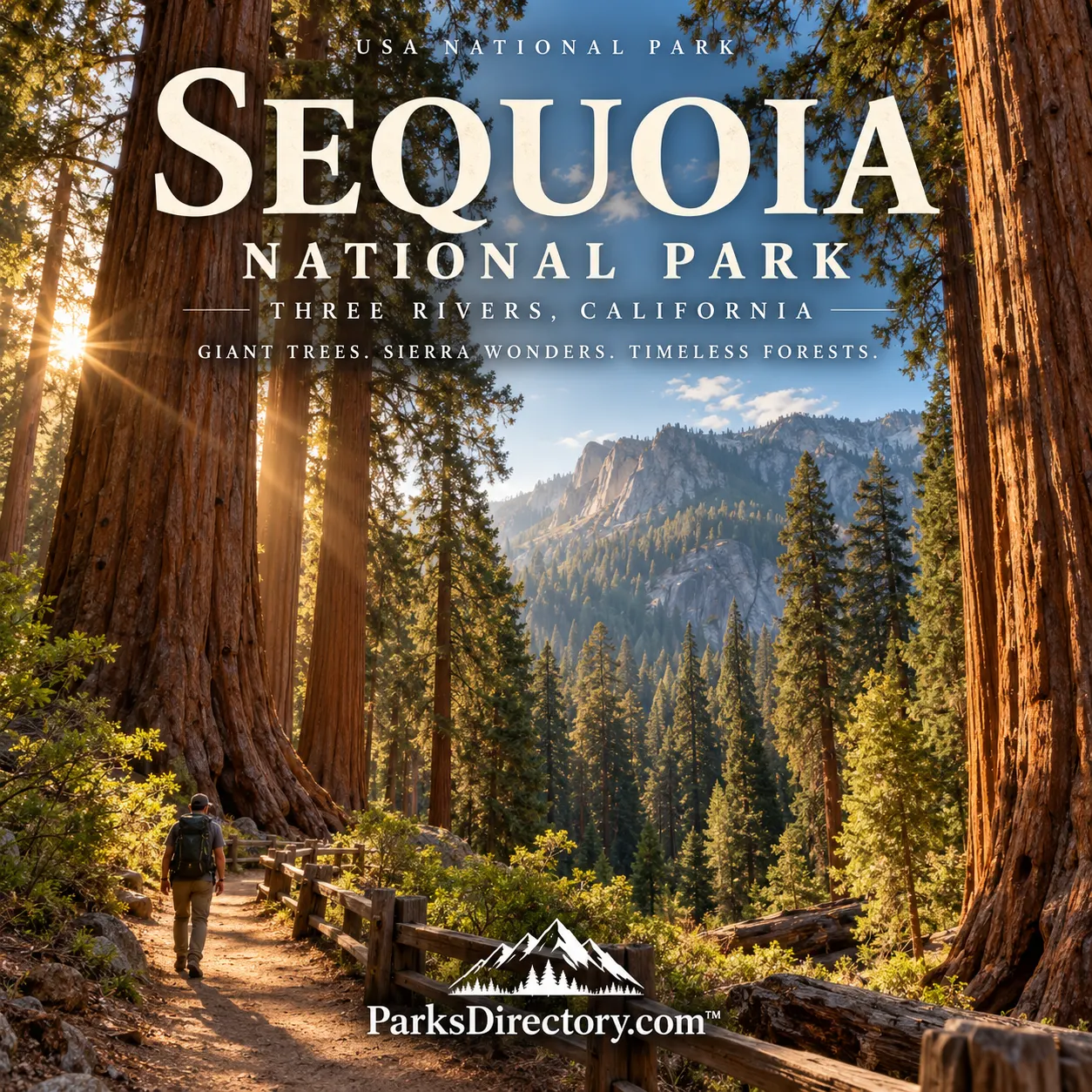
Sequoia National Park: Summary, History, and California’s Giant Forests
ParksDirectory.com™ | National Park Summary & History
Sequoia National Park is famous for trees that change a visitor’s sense of proportion. In the Giant Forest, reddish trunks rise from a living woodland to heights that are difficult to judge from below. But the park extends far beyond its signature groves. From California foothills to the crest of the Sierra Nevada, it protects granite landscapes, mountain forests, and alpine country. Its history connects the rescue of giant trees from logging with a much larger effort to preserve an entire mountain environment.[1][2]
Location, size, and the neighboring park
Sequoia lies in the southern Sierra Nevada of California, with Three Rivers serving as a principal western gateway. The park itself covers approximately 404,000 acres, or 631 square miles. This is not the same as the combined acreage of Sequoia and neighboring Kings Canyon, which the National Park Service reports as approximately 865,964 acres. They are distinct national parks, despite their shared administration and frequent appearance together on maps and visitor information.[2:1][3][4]
Their geography explains the partnership. Forested slopes, watersheds, and high mountain landscapes continue across administrative boundaries. Within Sequoia, the transition from foothills to high country is particularly dramatic. The giant-sequoia belt is one important environment within that larger progression, not a forest covering every acre of the park.[5]
Establishment in 1890
President Benjamin Harrison signed the legislation establishing Sequoia National Park on September 25, 1890. Protecting giant sequoias from logging was central to its creation. The park belongs to the earliest generation of American national parks, when advocates were still developing the idea that extraordinary natural places should remain in public protection rather than be judged principally by their immediate commercial value.[1:1]
The original boundaries did not encompass the entire modern park. A major expansion on July 3, 1926 added the Great Western Divide, Kern Canyon, and Mount Whitney country. This broadened Sequoia’s purpose from protecting famous groves toward safeguarding a much more extensive mountain landscape. Nearby General Grant National Park, established in 1890, later became part of Kings Canyon in 1940; Sequoia and Kings Canyon came under joint administration in 1943.[6][4:1]
Indigenous homelands and continuing connections
Federal establishment was not the beginning of human history here. The National Park Service identifies the broader Sequoia and Kings Canyon landscape as the homelands of the Mono or Monache, Yokuts, Tübatulabal, Paiute, and Western Shoshone. Native peoples used and tended resources, occupied the region, and maintained connections across elevations and mountain passes. Their relationships with these lands continue today.[7]
Settlement, forced relocation, and other colonial pressures disrupted those relationships. An accurate park history therefore cannot treat nineteenth-century Euro-American arrivals as the first people to know the forest. Nor should the word wilderness imply an absence of earlier stewardship. The cultural record adds depth to the scenery by showing that the mountains have long been places of knowledge, work, movement, and belonging.[7:1]
Early guardians and expanding access
Before the National Park Service existed, the United States Army played an important role in protecting Sequoia. Charles Young, who served as acting superintendent in 1903, is an especially significant figure in this history. Young and the Buffalo Soldiers helped improve access and protection, demonstrating that the early story of national parks included African American military leadership as well as the better-known conservation advocates.[6:1][8]
Road development later changed the scale of visitation. The Generals Highway, dedicated in 1935, linked Sequoia with General Grant National Park. A journey that had once required considerably more time and effort increasingly became an automobile excursion. The road remains part of the park’s historical landscape, illustrating the recurring challenge of making remarkable places accessible without overwhelming the qualities that made them worth protecting.[9]
General Sherman and the Giant Forest
The park’s best-known individual landmark is the General Sherman Tree, recognized as the world’s largest living tree by trunk volume. It stands roughly 275 feet tall, but its exceptional status rests on its massive volume rather than a claim to be the world’s tallest tree. That distinction matters: coast redwoods and giant sequoias are related but different trees, and their celebrated records are not interchangeable.[10]
The surrounding Giant Forest gives the famous tree its proper context. A grove is more than a collection of record holders. Giant sequoias grow among other conifers, with openings, fallen wood, and different generations of trees forming a functioning forest. Looking beyond Sherman reveals why conservation needs to protect entire groves and their ecological conditions rather than simply fence off a handful of named specimens.[11][5:1]
Granite viewpoints and the High Sierra
Moro Rock is another defining Sequoia landmark. Its granite dome rises above the forest, and the historic stairway offers a striking contrast between close views of stone and broad views of the mountains. The Great Western Divide appears as a formidable barrier beyond the more accessible western landscape. These viewpoints help explain the park’s scale more effectively than a map alone.[12]
Farther into the mountains, the park reaches the Mount Whitney region, which includes the highest summit in the contiguous United States. The High Sierra Trail, completed in 1932, helped connect the Giant Forest with that high country. Alpine lakes, glacially shaped basins, and bare granite belong to the same national park as the great trees, although their appearance and environmental conditions are entirely different.[1:2][13]
Restoring the forest around the attractions
Early tourism brought buildings, roads, and other facilities into the Giant Forest. Over time, development raised concerns about soil, roots, and the health of the groves. The park’s later removal and relocation of many facilities became a significant restoration effort. This history demonstrates that park management can involve undoing earlier visitor infrastructure, not merely adding new attractions.[14]
For a traveler, the lesson is useful: the apparent naturalness of a famous park setting may reflect difficult restoration decisions. Sequoia’s visitor experience has been deliberately reshaped as understanding of giant-tree ecology improved. The forest seen today is therefore both an ancient living system and a place affected by changing ideas about responsible public access.[14:1]
Fire and the future of the giants
Giant sequoias evolved with recurring fire. Their thick bark can protect them, and fire can create conditions that favor regeneration. However, this does not make them invulnerable. Recent severe wildfires have killed mature sequoias, showing the difference between an ecological fire regime and exceptionally destructive conditions intensified by drought and accumulated fuels.[11:1][15]
Sequoia’s importance now extends beyond saving trees from the saw. It includes understanding fire, climate, forest recovery, and the connections between groves and surrounding landscapes. Established in 1890 and enlarged through subsequent conservation efforts, the park preserves an extraordinary combination: monumental living trees, Indigenous homelands, a revealing history of public stewardship, and the immense mountain country rising behind the forest.[6:2][7:2][15:1]
Sources
Research checked September 6, 2026. Sequoia-only acreage is rounded and distinguished from the combined Sequoia–Kings Canyon management area.
National Park Service, “History & Culture.” https://www.nps.gov/seki/learn/historyculture/index.htm ↩︎ ↩︎ ↩︎
National Park Service, “NPS Geodiversity Atlas—Sequoia and Kings Canyon National Parks.” https://www.nps.gov/articles/nps-geodiversity-atlas-sequoia-and-kings-canyon-national-parks-california.htm ↩︎ ↩︎
National Parked, “Sequoia & Kings Canyon Fast Facts,” acreage entry only. Rounded area is used; historical dates are verified separately against NPS sources. https://www.nationalparked.com/sequoia-kings-canyon ↩︎
National Park Service, “Quick Fact Sheet.” https://www.nps.gov/seki/learn/news/quick-fact-sheet.htm ↩︎ ↩︎
National Park Service, “Plants.” https://www.nps.gov/seki/learn/nature/plants.htm ↩︎ ↩︎
National Park Service, “Fact Sheet.” https://www.nps.gov/seki/learn/news/fact-sheet.htm ↩︎ ↩︎ ↩︎
National Park Service, “Native Americans of the Southern Sierra.” https://www.nps.gov/seki/learn/historyculture/native-americans.htm ↩︎ ↩︎ ↩︎
National Park Service, “People.” https://www.nps.gov/seki/learn/historyculture/people.htm ↩︎
National Park Service, “When Two Parks Meet: The History of the Generals Highway.” https://www.nps.gov/seki/learn/historyculture/generals-highway.htm ↩︎
National Park Service, “The General Sherman Tree.” https://www.nps.gov/seki/learn/nature/sherman.htm ↩︎
National Park Service, “Giant Sequoias.” https://www.nps.gov/seki/learn/nature/bigtrees.htm ↩︎ ↩︎
National Park Service, “Moro Rock & Other Granite Domes.” https://www.nps.gov/seki/planyourvisit/moro.htm ↩︎
National Park Service, “Wilderness.” https://www.nps.gov/seki/planyourvisit/wilderness.htm ↩︎
National Park Service, “History of Giant Forest Development.” https://www.nps.gov/seki/learn/historyculture/gfhistory.htm ↩︎ ↩︎
National Park Service, “Giant Sequoias and Fire.” https://www.nps.gov/seki/learn/nature/giant-sequoias-and-fire.htm ↩︎ ↩︎