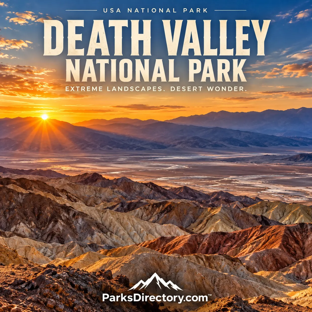
Death Valley National Park

Death Valley, California · California outdoor places

Death Valley National Park

History

Death Valley National Park: Desert Extremes and the Long History of an Inhabited Landscape

ParksDirectory.com™ | National Park Summary & History

Location, area, and establishment

Death Valley National Park straddles eastern California and western Nevada, east of the Sierra Nevada. It protects much more than the valley that supplies its name: mountain ranges, additional basins, canyons, dunes, springs, and remote desert country form a vast connected landscape. At approximately 3.4 million acres, or roughly 5,300 square miles, it is the largest national park in the contiguous United States. The rounded area reflects the scale reported in National Park Service descriptions rather than a new boundary measurement.[1]

President Herbert Hoover proclaimed Death Valley National Monument on February 11, 1933. Congress subsequently expanded and redesignated it through the California Desert Protection Act, signed October 31, 1994. That legislation added about 1.3 million acres and designated extensive wilderness. The park’s history therefore has two principal federal milestones: initial monument protection in 1933 and a much larger national-park framework in 1994.[2][3]

A homeland beneath a forbidding name

The name Death Valley can encourage the mistaken impression that the region is hostile to all life and unsuitable for human belonging. For the Timbisha Shoshone, however, it is an ancestral homeland. Seasonal movement, knowledge of water, and the harvesting of foods such as mesquite beans and pinyon nuts supported life across different elevations. Sacred places and enduring relationships with the land are central to that history.[4]

European American travelers, prospectors, and entrepreneurs later attached a different set of stories to the desert. Mining camps appeared and disappeared, and accounts of danger helped establish the region’s popular image. Those narratives are part of the park’s history, but they should not displace the experience of people who understood the landscape as home. A serious overview must hold both perspectives together: the desert could be unfamiliar and frightening to newcomers while remaining culturally meaningful and knowable to its longstanding inhabitants.[4:1]

Borax, labor, and the growth of a public image

Harmony Borax Works, near Furnace Creek, is one of the clearest surviving connections to the valley’s industrial past. Following the discovery of borax nearby in 1881, William T. Coleman developed a processing operation during the early 1880s. The difficulty of moving finished material to market helped produce the famous twenty-mule-team transportation story. The operation’s remains make it possible to connect the landscape with labor, technology, and commercial ambition rather than treating mining as an abstract footnote.[5]

The National Park Service notes that Chinese workers formed much of the Harmony labor force. Their work deserves attention alongside the better-known images of wagons and entrepreneurs. Heat affected production itself: processing water could become too warm for borax to crystallize effectively. Here, environmental conditions did not merely make life uncomfortable; they shaped the practical limits of industry. The historic site shows how mineral wealth, labor arrangements, and extreme climate interacted.[5:1]

Why the protected landscape grew

The 1933 monument recognized a remarkable desert, but later conservation involved a broader view of its ecological and scenic connections. The 1994 legislation protected additional country beyond the familiar central valley and linked national-park status with wilderness designation. Its significance was not simply a change of sign at an entrance. It enlarged the scale at which the landscape could be managed and preserved.[2:1][3:1]

That expansion helps explain the park’s unusual diversity. An account limited to the lowest salt flats leaves out high mountains, remote valleys, and habitats supported by springs. The modern park protects relationships among these environments. Its size matters because geological structures, animal movement, watersheds, and the experience of undeveloped space rarely conform to the narrow boundaries that might be drawn around a single famous viewpoint.[1:1]

A geological landscape in unusually clear view

Death Valley belongs to the Basin and Range region, where crustal movement has helped create alternating mountains and basins. Sparse vegetation exposes rock layers, faults, slopes, and alluvial deposits that would be harder to read in a densely forested setting. The landscape records ancient environments as well as more recent erosion, sediment movement, and changing water conditions. Even a dry basin can preserve evidence of a much wetter past.[1:2]

The elevation contrast is extraordinary. Badwater Basin lies 282 feet below sea level, while the Panamint Mountains rise more than 11,000 feet above it. The resulting range of conditions helps account for the park’s biological variety. The National Park Service describes more than a thousand plant species, from short-lived wildflowers to high-elevation trees. “Desert” here describes a broad climatic setting, not a uniform surface of sand.[6]

The most notable sights

Badwater Basin is the best-known expression of the valley floor, where salt and open space reveal the effects of evaporation. Zabriskie Point and Golden Canyon emphasize eroded badlands and layered terrain. Dante’s View provides a wider perspective on the basin and surrounding mountains. Comparing these places makes the geology easier to understand: the view from above explains relationships that can be difficult to recognize while standing on the floor.[7]

The park is also associated with its sand dunes, colorful rock formations, rugged canyons, springs, and dark night skies. The Racetrack and Devils Hole represent very different aspects of its natural history: one is known for a desert-playa phenomenon, the other for an exceptionally restricted aquatic habitat. Their inclusion in the wider park story demonstrates how seemingly unlikely features can belong to the same desert system.[1:3][6:1]

Wildflowers add another dimension, but their appearance depends on conditions rather than a reliable annual spectacle. Similarly, mountain snow, temporary water, and changing light remind visitors that this landscape is dynamic. Its reputation for heat is important, yet the park’s deeper identity lies in variation and adaptation rather than a single environmental extreme.[1:4][6:2]

What Death Valley preserves

Death Valley protects a landscape where deep geological time is unusually visible and where human history is inseparable from knowledge of scarce resources. Its national significance includes the Timbisha homeland, industrial remains, scientific resources, desert biodiversity, and the sheer continuity of protected space. Those elements should be understood together, not divided into a scenic park and an unrelated historical appendix.

The 1933 and 1994 milestones mark changes in federal protection, not the beginning of the landscape’s value. Death Valley’s most lasting lesson is that a place described as empty may contain a remarkable density of natural and cultural stories. Its scale invites distant views, but its history rewards closer attention to a spring, a plant, a worksite, or the people whose relationship with the desert continues.

Sources

Research checked September 6, 2026. Acreage is intentionally approximate; cited NPS publications report figures from different boundary-accounting dates.


  1. National Park Service, Geodiversity Atlas: Death Valley National Park. ↩︎ ↩︎ ↩︎ ↩︎ ↩︎

  2. National Park Service, General Management Plan: Background. ↩︎ ↩︎

  3. National Park Service, Twenty-Fifth National-Park Anniversary. ↩︎ ↩︎

  4. National Park Service, People. ↩︎ ↩︎

  5. National Park Service, Harmony Borax Works. ↩︎ ↩︎

  6. National Park Service, Nature & Science. ↩︎ ↩︎ ↩︎

  7. National Park Service, Hiking and Landscape Features. ↩︎

Travel guide

Death Valley National Park: A Guide to Desert Scale, Color, and Light

Death Valley National Park is a lesson in looking beyond a name. Salt flats, sand dunes, eroded hills, and mountain slopes create a landscape of remarkable variety. Open country can appear simple from the highway, yet a change in light reveals folds and textures that were nearly invisible moments earlier. The park rewards travelers who prepare carefully enough to spend time observing rather than constantly moving toward the next distant attraction.[1]

Preparation is inseparable from enjoyment here. Heat, distance, and road conditions determine what kind of visit is sensible. A well-designed itinerary respects those limits and uses them to create a focused experience instead of treating them as obstacles to overcome.

Build the visit around conditions

The first decision should concern when and how you intend to spend time outside. The National Park Service identifies cooler months as the more suitable period for lower-elevation hiking. Summer heat makes ordinary desert walks dangerous, and strenuous low-elevation outings should not be forced into a hot-weather itinerary. Spring and autumn can also be hotter than visitors expect.[2][3]

A driving visit with brief stops near an air-conditioned vehicle is a different activity from a hiking holiday. Beginning early does not automatically make a demanding walk safe. Use the forecast, park guidance, and the group’s condition to decide whether an outing should be shortened or abandoned.

Carry emergency water in the vehicle as well as the supplies needed for each walk. Water does not authorize you to exceed safe limits; it is one element of preparation that also includes food, shade, a dependable vehicle, and realistic distances.

Start with central-valley highlights

Furnace Creek provides a useful orientation point. Many introductory itineraries connect Badwater Basin, Zabriskie Point, Artists Drive, and other established scenic stops. They reveal different aspects of the desert, but their separation means the day should be planned rather than improvised.[1:1]

Badwater Basin introduces the salt-flat environment. In suitable cool conditions, the experience is less about walking as far as possible than about observing the surface and surrounding mountain walls. During heat, the apparent simplicity of flat terrain is no reason to undertake a long exposed walk.[2:1]

Zabriskie Point offers a different perspective across sculpted badlands. Pause long enough to see how ridges overlap and shadows reveal their form. The viewpoint itself can be satisfying without adding a longer route through the terrain below. Choose the experience that suits the conditions rather than extending every stop automatically.

Explore color and sand

Artists Drive adds varied colors and rock forms to a central-valley visit. Check current road information and vehicle restrictions before entering any scenic spur, especially in a larger vehicle. A named attraction does not guarantee that every motorhome or rental vehicle can reach it appropriately.[1:2]

Mesquite Flat Sand Dunes offer scenery shaped by wind. Even a modest walk from an appropriate access point reveals ripples and changing dune profiles. Progress through sand is slower than travel on a firm path, and the return requires effort. Decide on a conservative distance before fatigue or heat makes the choice for you.[2:2]

Low-angle light can emphasize dunes and badlands, but photography should not override the return plan. A nearby composition often works better than a distant crest that requires much more walking than expected. Let safe access and the day’s conditions guide where you stop to look.[4]

Choose one serious walk, not several

In suitable conditions, Golden Canyon and the associated badlands routes offer a closer encounter with the landscape. Mosaic Canyon provides another distinctive setting, with polished rock and narrower sections. Such walks differ from constructed woodland paths: route choices, footing, and exposure may matter as much as mileage.[2:3]

Research the exact route, identify the intended turnaround, and check storm forecasts. Narrow terrain is not a place to dismiss rain because the sky immediately overhead appears clear. A map should support your understanding, not replace attention to changing conditions.

Higher-elevation trips require separate preparation. Cooler temperatures do not make a mountain route easy, and snow can remain a concern when the valley is warm. Do not substitute a high summit for a canceled desert walk without understanding the different terrain and equipment demands.

Treat roads as part of the plan

Flood damage can affect access long after a storm ends. Check the current road report before entering the park and again before choosing a remote destination. An old itinerary may depend on roads or facilities that are no longer available.[5]

For a first visit, favor open paved roads and established stops. Backcountry driving requires attention to vehicle suitability, repairs, communications, and self-sufficiency. A navigation app may display a route without understanding whether your vehicle or experience fits it.

In hot conditions, park guidance advises staying with a disabled vehicle rather than walking away across the desert. Limited mobile coverage and long distances make advance preparation particularly important. Leave your intended route with someone when traveling beyond busy visitor areas.[3:1]

Choose accommodation around the journey

A base near the activities you intend to prioritize can reduce repeated driving. Compare lodging or camping according to actual access, seasonal services, meals, and fuel rather than the apparent distance to the park boundary. The boundary is not necessarily close to your first viewpoint.

A long sightseeing day followed by an unexpectedly lengthy drive in darkness can undermine an otherwise good plan. Keep departure and return times realistic. Travelers covering a wider Southwestern route should consider whether an additional night is more useful than trying to see the park between two long highway transfers.

Prepare simple food and water arrangements before the day’s main outing. A packed lunch allows you to rest when needed instead of leaving a comfortable spot to search for a service that may be far away or closed.

A suggested cool-season visit

Use the first day for orientation at Furnace Creek and a manageable selection of central-valley viewpoints. Add a short walk only when conditions support it. Keep the afternoon flexible enough for a rest or a return to a favorite view under different light.

Dedicate the second day to the dunes or one researched canyon walk rather than attempting several remote corners. This creates a contrast between broad scenery and close observation. Visitors with one day should reduce the number of destinations, not eliminate water stops, meals, or safety margins.

The sequence is an editorial suggestion, not a promise that every road or route will be open. Let current information decide which combination works.

Leave the desert undisturbed

Keep vehicles on permitted roads, leave rocks and historic objects in place, and avoid damaging vegetation or fragile ground. Do not create new tracks or rearrange natural features for a photograph. Respect closures even when the country beyond them appears easy to cross.

Death Valley’s strongest memories often come from a quiet stop rather than a strenuous accomplishment. Watch light move across a ridge, notice the distance between mountain ranges, and allow careful planning to make room for the desert’s remarkable variety.

Sources

Prepared September 6, 2026. Suggested itineraries are editorial recommendations. Check official park alerts, reservations, and operating information before traveling.


  1. National Park Service, Park Highlights. ↩︎ ↩︎ ↩︎

  2. National Park Service, Hiking. ↩︎ ↩︎ ↩︎ ↩︎

  3. National Park Service, Summer Guide. ↩︎ ↩︎

  4. National Park Service, Sunrise and Sunset. ↩︎

  5. National Park Service, Current Conditions. ↩︎