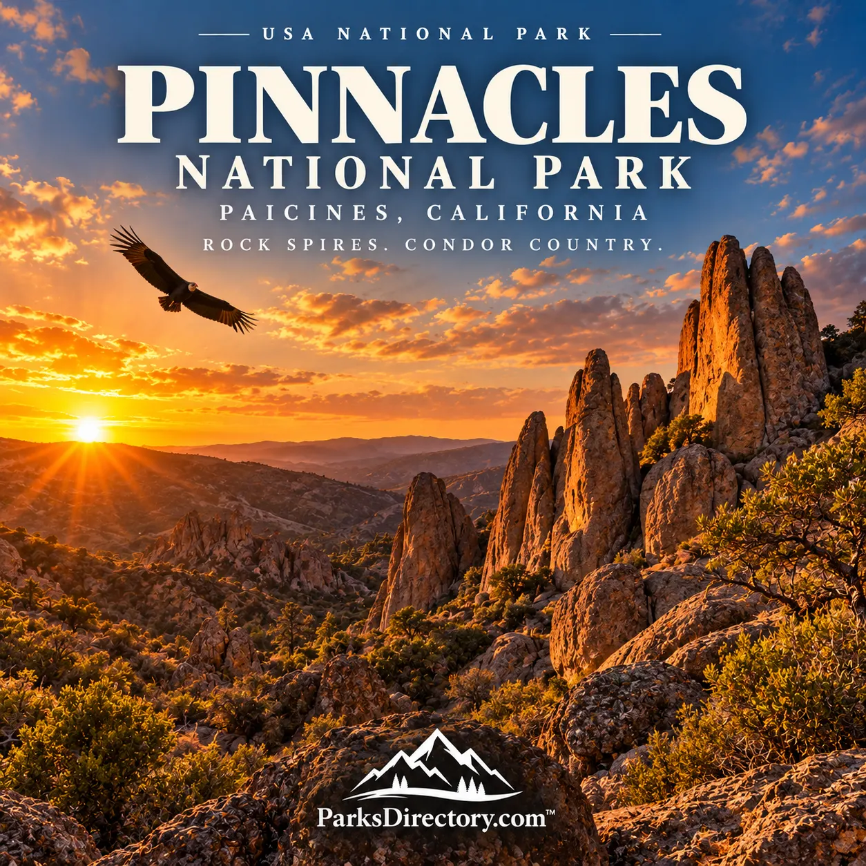
Pinnacles National Park: A Traveling Volcano, Talus Caves, and the Return of Condors
ParksDirectory.com™ | National Park Summary & History
A distinctive corner of California
Pinnacles National Park protects a landscape of rock spires, narrow canyons, oak woodland, and chaparral in California’s interior Coast Ranges. Its formations look dramatic enough on their own, but their history is even more remarkable: the volcanic rocks originated far to the southeast and were carried northward through movement along the San Andreas fault system.[1]
The park lies in the southern Gabilan Range, in San Benito and Monterey counties, inland from the central California coast. Paicines is associated with the eastern approach and park mailing address; the protected area extends across rugged country with distinct eastern and western access points. The NPS geological overview gives approximately 26,686 acres, about 42 square miles.[2]
Pinnacles is compact compared with many western national parks, yet its varied terrain supports a broad range of habitats. A journey from an open slope into a shaded canyon can reveal a noticeable change in plants, temperature, and wildlife activity.[1:1][3]
When the park was created
President Theodore Roosevelt proclaimed Pinnacles National Monument on January 16, 1908. The original designation recognized the area’s unusual rock formations and caves, establishing federal protection for a much smaller area than the park occupies today.[2:1][4]
Pinnacles became a national park on January 10, 2013, when President Barack Obama signed legislation redesignating the monument. The later date did not mark the beginning of protection. It represented a new designation after more than a century of conservation, land additions, research, and public use.[5]
That long interval is central to the park’s story. Pinnacles did not suddenly become important in 2013; its geological, ecological, and cultural value had been recognized and defended by generations of people. National-park status brought a different public profile to an already established protected landscape.[4:1][5:1]
Indigenous relationships with the Gabilan landscape
Indigenous peoples lived around and used the Pinnacles landscape long before homesteaders or tourists arrived. The NPS account emphasizes the gathering of useful plant and animal resources and the continuing significance of the place to Native communities.[6]
It also makes an important archaeological distinction: evidence of resource use does not automatically establish that a permanent village stood within today’s park boundaries. Respecting that distinction avoids replacing the available evidence with an appealing but unsupported story.[6:1]
Grinding stones and other traces help illustrate relationships with local resources. The surrounding region was a lived landscape, shaped by knowledge of seasons, plants, animals, and routes. National-park designation is therefore one chapter in the area’s human history, not its beginning.[6:2]
A volcano that changed its address
The rocks central to Pinnacles formed in a volcanic field approximately 22–23 million years ago, near present-day Lancaster in southern California. Eruptions produced different volcanic materials, building a landscape that was later divided and displaced by tectonic movement.[7]
Movement along the San Andreas fault system carried the Pinnacles portion roughly 195 miles northwest from its place of origin. Related rocks near Neenach help geologists connect the separated parts. The park is consequently a striking example of how the position of a landscape can change over geological time.[8]
The pinnacles visible today are erosional remnants, not an actively erupting volcano. Wind, water, weathering, and rockfall have reshaped the volcanic material into cliffs, towers, narrow passages, and other distinctive forms. Understanding both movement and erosion explains more than simply calling the area volcanic.[7:1][8:1]
High Peaks and the signature rock formations
The High Peaks are among the park’s most recognizable features. Their exposed formations give hikers close views of the rocky core that inspired early protection. Seen against the surrounding hills, the spires emphasize how different the volcanic remnants are from the gentler terrain around them.[2:2][9]
The experience is not limited to distant scenery. Trails move through changes in slope and exposure, revealing the shapes and textures of the rock at a human scale. Pinnacles is especially distinctive because its best-known formations can feel both monumental and intricate.[9:1]
Rock climbing and hiking became important parts of the visitor tradition, but the cliffs also provide wildlife habitat. Recreational significance and ecological significance occupy the same places, which is one reason protected landscapes require management rather than simple unrestricted access.[3:1]
Caves made by fallen boulders
Pinnacles is also famous for its talus caves, particularly at Bear Gulch and Balconies. These spaces formed where large fallen rocks created covered passages within narrow canyons. Their origin differs from the chemical dissolution that produces many limestone cave systems.[9:2]
The caves extend the geological story from volcanic formation to erosion and collapse. They are not separate curiosities hidden beneath the landscape; they are products of the same cliffs and canyon processes visible above ground.[2:3][9:3]
They also provide important habitat. Bear Gulch supports Townsend’s big-eared bats, while the Balconies area supports western mastiff bats. The biological importance of these spaces explains why cave protection cannot be judged solely by their appeal to visitors.[10]
Local advocates and the early monument
Homesteader Schuyler Hain became a leading advocate for protecting Pinnacles after arriving in the area in 1891. He led visitors into the formations and caves, wrote about their value, and worked to build public interest in preservation.[4:2]
Local families and a group known as the Pinnacles Boys also contributed to early access and development. Their work helped establish roads and facilities before the better-funded federal projects that followed. The monument’s history therefore includes community initiative as well as presidential action.[4:3]
During the 1930s, the Civilian Conservation Corps built trails, tunnels, the Bear Gulch Dam, and other visitor infrastructure. Some familiar features of the park experience reflect that Depression-era labor, connecting today’s recreational landscape with a national program of employment and conservation.[9:4]
California condors and active conservation
The return of California condors is one of Pinnacles’ most notable modern stories. The park became a condor release site in 2003, participating in the larger effort to recover a species that had disappeared from the wild before captive-breeding and release programs began.[5:2][11]
Condor recovery depends on continuing monitoring and cooperation beyond park boundaries. These wide-ranging birds do not remain inside a protected area, and threats such as lead exposure illustrate why landscape conservation alone cannot solve every wildlife problem.[11:1]
Their presence gives the High Peaks a living dimension that complements the ancient geology. A condor overhead is not merely another scenic attraction; it represents sustained work by biologists, partner organizations, and communities to restore a species to its environment.[11:2]
A small park with a long reach
Pinnacles’ appeal lies in the convergence of very different timescales. Tectonic movement explains the rocks, Indigenous relationships explain an older human geography, local campaigns explain protection, and wildlife recovery explains part of the park’s present significance.
Its best-known sights—High Peaks, Bear Gulch, Balconies, and condors—are most rewarding when understood together. The result is not simply a collection of unusual formations, but a compact national park that reveals how geology, community effort, and conservation can shape the same place across millions of years.
Sources
Research checked September 6, 2026. Acreage is approximate and follows the NPS geological overview. Wildlife discussion avoids a current population count; cave and trail access can change independently of this historical summary.
National Park Service, “Pinnacles National Park.” https://www.nps.gov/pinn/index.htm ↩︎ ↩︎
National Park Service, “NPS Geodiversity Atlas—Pinnacles National Monument, California.” https://www.nps.gov/articles/nps-geodiversity-atlas-pinnacles-national-monument-california.htm ↩︎ ↩︎ ↩︎ ↩︎
National Park Service, “Things To Do.” https://www.nps.gov/pinn/planyourvisit/things2do.htm ↩︎ ↩︎
National Park Service, “Spanish Missionaries and Early Settlers.” https://www.nps.gov/pinn/learn/historyculture/spanish-missionaries-and-early-settlers.htm ↩︎ ↩︎ ↩︎ ↩︎
National Park Service, “Present Day.” https://www.nps.gov/pinn/learn/historyculture/present-day.htm ↩︎ ↩︎ ↩︎
National Park Service, “Native Peoples.” https://www.nps.gov/pinn/learn/historyculture/native-peoples.htm ↩︎ ↩︎ ↩︎
National Park Service, “How Pinnacles Formed.” https://www.nps.gov/pinn/learn/nature/how-pinnacles-formed.htm ↩︎ ↩︎
National Park Service, “Geology.” https://www.nps.gov/pinn/learn/nature/geology.htm ↩︎ ↩︎
National Park Service, “Park Brochure.” https://www.nps.gov/pinn/planyourvisit/park-brochure.htm ↩︎ ↩︎ ↩︎ ↩︎ ↩︎
National Park Service, “Bats.” https://www.nps.gov/pinn/learn/nature/bats.htm ↩︎
National Park Service, “California Condors at Pinnacles.” https://www.nps.gov/pinn/learn/nature/condor.htm ↩︎ ↩︎ ↩︎