Redwood National Park: Ancient Forests and the Work of Bringing a Landscape Back
ParksDirectory.com™ | National Park Summary & History
A park measured in trees and watersheds
Redwood National Park is famous for coast redwoods, the world’s tallest trees, but its protected landscapes also include prairies, oak woodlands, rivers, and Pacific shoreline. The towering groves are part of a much larger ecological setting. Their survival depends on water, soils, surrounding forests, and conditions beyond the base of any individual tree.[1]
The park lies in Del Norte and Humboldt counties in northwestern California, near the Oregon border. Crescent City is a northern gateway and administrative community; Orick is another important community farther south. Visitors usually experience Redwood through the cooperatively managed Redwood National and State Parks, rather than through the federal unit in isolation.[2][3]
The NPS describes the combined parklands as approximately 138,999 acres, about 217 square miles. Its fact sheet separately lists 71,715 federal acres, roughly 112 square miles. These are different reporting categories: the combined area is not federal ownership alone, and the parkland figures exclude submerged lands and public roads. A useful size description must identify that scope.[3:1]
When Redwood National Park was created
Redwood National Park was established on October 2, 1968, when President Lyndon B. Johnson signed the legislation. The new federal park protected surviving ancient groves after decades of intensive logging had transformed much of the coast redwood region.[4]
Its establishment came later than the three state parks now managed with it. Prairie Creek Redwoods State Park dates to 1923, Del Norte Coast Redwoods State Park to 1925, and Jedediah Smith Redwoods State Park to 1929. Those earlier protections preserved important forests before a national park became politically possible.[3:2]
The national park expanded on March 27, 1978, under President Jimmy Carter. In 1994, the National Park Service and California State Parks agreed to cooperative management of the four parks. These milestones explain why the destination’s familiar name includes both national and state parks.[3:3][4:1]
Indigenous homelands on the North Coast
The redwood country has a deep and continuing Indigenous history. Yurok, Tolowa, Chilula, Hupa, Karuk, and other regional communities have distinct relationships with places across the North Coast. The NPS identifies the Yurok, Tolowa, and Chilula specifically with lands included within the park system.[3:4][5]
Fishing, gathering, hunting, travel, and cultural practices connected forests with rivers and the ocean. These were managed and understood landscapes, not unused places awaiting outside discovery. Tribal communities remain part of the region’s life and its conservation future.[5:1]
Cultural burning provides one example of that long stewardship. Indigenous peoples used fire to influence plant communities, maintain resources, and support open areas. Recognizing such practices broadens the meaning of conservation beyond the idea that caring for land always requires leaving it entirely untouched.[6]
What makes coast redwoods extraordinary
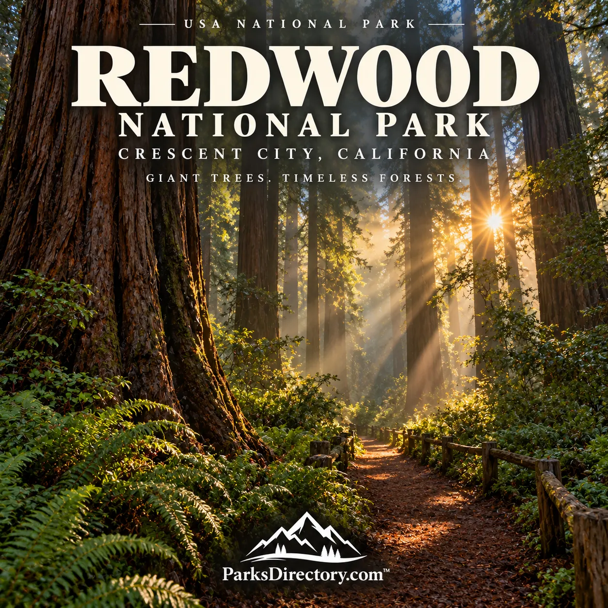
The coast redwood, Sequoia sempervirens, dominates the park’s most celebrated forests alongside trees such as Douglas-fir. The redwoods’ scale can be difficult to absorb from a photograph: trunks rise through layered vegetation into a canopy far above the forest floor.[7]
High rainfall, summer fog, a mild climate, suitable soils, and shelter from wind help support their growth. Fog is especially important during the drier part of the year because it reduces moisture stress. The forests therefore belong to a particular coastal environment, not simply to any place where a seed might be planted.[8]
Their importance also extends beyond height records. An ancient forest includes young trees, large living trunks, dead wood, understory plants, and many organisms that depend on those conditions. Protecting only the tallest specimen would leave much of the ecosystem unprotected.[7:1][9]
Logging and the preservation movement
Commercial redwood logging expanded during the nineteenth century, supplying a growing market for durable timber. As cutting accelerated, old-growth forests declined across the region. Preservation advocates responded by raising money and acquiring groves before they disappeared.[4:2]
The Save-the-Redwoods League, active from the late 1910s, played a major role in that movement. State-park protection preserved important areas, but the continuing scale of logging eventually strengthened the campaign for a federal park. The 1968 legislation emerged from difficult negotiations over economic interests and conservation.[4:3]
The surviving forests should therefore be understood partly as the result of organized public effort. Their presence was not guaranteed by remoteness or size. The protected groves are evidence of choices made while surrounding landscapes were being rapidly altered.[4:4]
Why the 1978 expansion mattered
The first national-park boundary did not fully protect the watersheds supporting its famous groves. Logging and road construction upstream contributed sediment and instability that could affect streams and forests already inside the park. Protection drawn around trees alone proved insufficient.[10]
The 1978 expansion addressed that larger landscape and directed a restoration effort. Much of the added land had already been logged, making the park responsible for recovery as well as preservation. This was a significant shift: a national park could include damaged land because restoring it was essential to protecting the whole.[10:1]
That history helps explain why visitors encounter both ancient forest and younger stands. Their contrast is part of Redwood’s conservation story, not a reason to assume that only the oldest groves deserve attention.[10:2]
Restoration as a continuing purpose
Restoration work includes treating old logging roads, improving stream conditions, reducing erosion, and thinning unusually dense second-growth stands where appropriate. These interventions aim to support healthier forest structure and watershed function over time.[11]
Partnerships such as Redwoods Rising bring together park agencies, conservation organizations, and other participants. Stream restoration can also involve Tribal crews and knowledge. The work demonstrates that recovery at this scale requires cooperation across organizational boundaries.[11:1][12]
A repaired stream or a recovering slope may not attract the immediate attention of a giant tree, yet those changes are central to Redwood’s future. Restoration connects the surviving old growth with the possibility of more resilient forests for later generations.[12:1]
The groves visitors remember
Lady Bird Johnson Grove offers a well-known introduction to old-growth forest and the national park’s dedication history. Tall Trees Grove, along Redwood Creek, connects the experience of exceptional trees with the watershed issues that shaped the park’s expansion.[13]
The adjoining state parks add their own groves, trails, and coastal environments to the broader visit. Their shared management makes the experience feel continuous, even though their legal histories remain distinct. A good guide should celebrate that continuity without erasing the differences.[3:5][13:1]
More than a monument to size
Redwood’s wildlife offers another reason to look beyond tree height. The marbled murrelet, a seabird associated with old-growth coastal forests, illustrates the connection between the canopy and the ocean. Protecting its habitat requires attention to an entire system rather than one isolated attraction.[14]
Redwood National Park is consequently both a refuge and a restoration landscape. Its history joins Indigenous stewardship, industrial exploitation, public advocacy, and long-term ecological repair. The greatest trees are the most visible introduction, but the deeper story is how people chose to protect—and then rebuild—the living world around them.
Sources
Research checked September 6, 2026. Combined parklands and federally reported acreage are labeled separately; the fact sheet’s categories should not be treated as an interchangeable park-only measurement. Square miles are rounded.
National Park Service, “Redwood National and State Parks.” https://www.nps.gov/redw/index.htm ↩︎
National Park Service, “NPS Geodiversity Atlas—Redwood National Park and State Parks, California.” https://www.nps.gov/articles/nps-geodiversity-atlas-redwood-national-park-and-state-parks-california.htm ↩︎
National Park Service, “Park Facts.” https://www.nps.gov/redw/learn/park-facts.htm ↩︎ ↩︎ ↩︎ ↩︎ ↩︎ ↩︎
National Park Service, “Redwood Area History.” https://www.nps.gov/redw/learn/historyculture/area-history.htm ↩︎ ↩︎ ↩︎ ↩︎ ↩︎
National Park Service, “Local Area History.” https://www.nps.gov/redw/learn/historyculture/local-area-history.htm ↩︎ ↩︎
National Park Service, “Fall Prescribed Fire in the Bald Hills.” https://www.nps.gov/redw/learn/news/rxfire2019.htm ↩︎
National Park Service, “Plants.” https://www.nps.gov/redw/learn/nature/plants.htm ↩︎ ↩︎
National Park Service, “Frequently Asked Questions.” https://www.nps.gov/redw/faqs.htm ↩︎
National Park Service, “Natural Features & Ecosystems.” https://www.nps.gov/redw/learn/nature/naturalfeaturesandecosystems.htm ↩︎
National Park Service, “Then and Now—Protection and Restoration.” https://www.nps.gov/redw/learn/historyculture/thenandnow6.htm ↩︎ ↩︎ ↩︎
National Park Service, “Second-Growth Forests and Restoration Thinning.” https://www.nps.gov/redw/learn/nature/forestthinning.htm ↩︎ ↩︎
National Park Service, “Restoring the Waterflow.” https://www.nps.gov/redw/learn/nature/riperianrestoration.htm ↩︎ ↩︎
National Park Service, “Trails—South of the Klamath River.” https://www.nps.gov/redw/planyourvisit/hiking-trails-south.htm ↩︎ ↩︎
National Park Service, “Marbled Murrelet.” https://www.nps.gov/redw/learn/nature/marbled-murrelet.htm ↩︎