Zion National Park: Summary, History, Sandstone Cliffs, and the Virgin River
ParksDirectory.com™ | National Park Summary & History
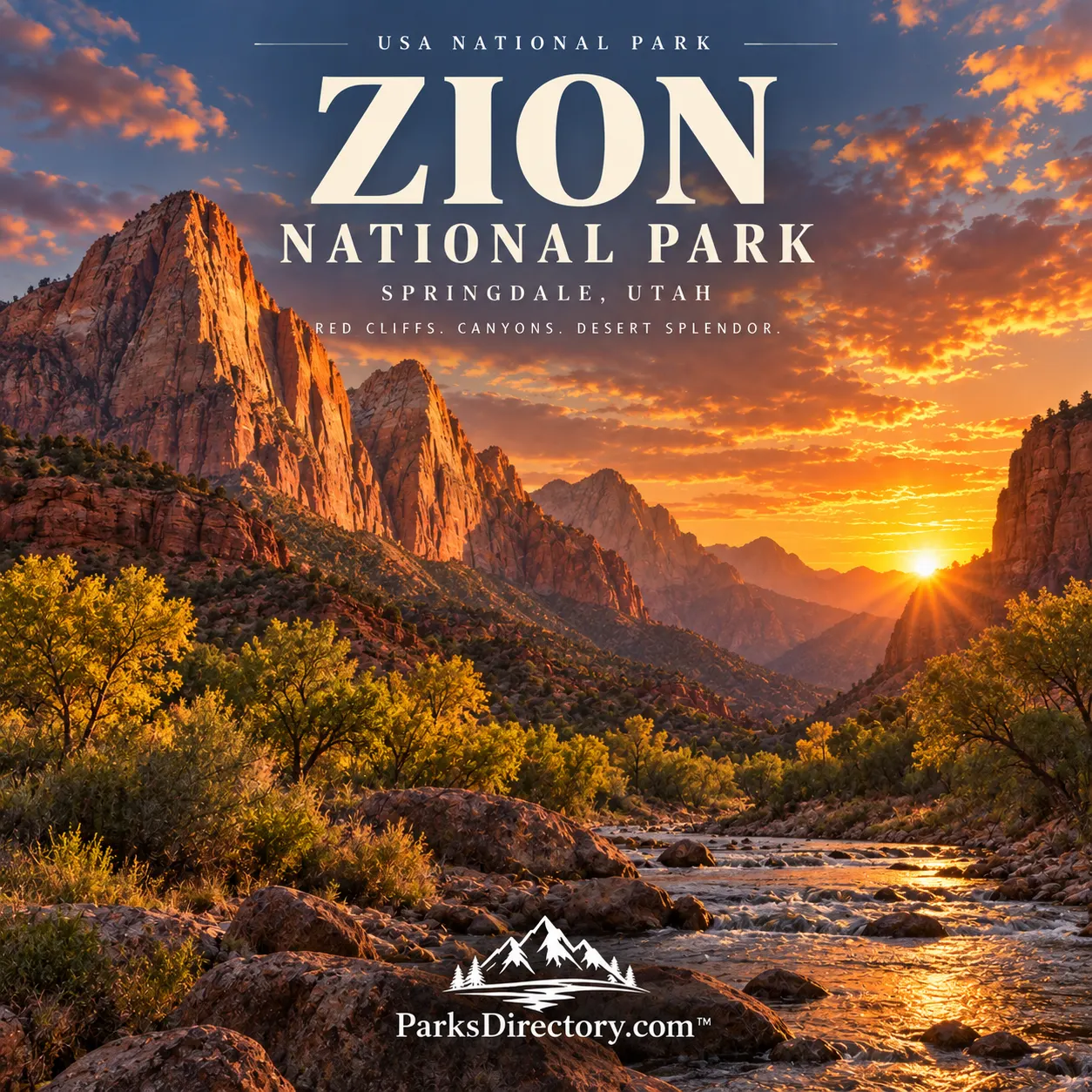
Zion National Park is a landscape experienced from inside the canyon. Instead of looking only across a distant panorama, visitors stand beneath walls of cream, rose, and red sandstone, with the Virgin River winding through the foreground. The contrast between towering rock and narrow green corridors gives the park its distinctive character. Zion is famous for adventurous trails, but its deeper story combines Indigenous homelands, settlement, changing protection, and water reshaping a desert landscape.[1]
Location and total area
Zion lies in southwestern Utah, along the edge of the Colorado Plateau, within Washington, Iron, and Kane counties. The NPS Geodiversity Atlas reports approximately 147,237 acres, equivalent to about 230 square miles. Springdale borders the principal Zion Canyon entrance, while other parts of the park extend into higher plateaus and less-developed canyon country.[2][3]
The main canyon is therefore only one part of Zion. Kolob Canyons occupies the park’s northwestern section, and the broader protected landscape includes terraces, mesas, narrow ravines, and exposed slickrock. Understanding that geography helps distinguish the national park from the single scenic corridor most often shown in photographs.[2:1][4]
When Zion became a national park
Federal protection began on July 31, 1909, when President William Howard Taft proclaimed Mukuntuweap National Monument. The original monument protected approximately 16,000 acres around the canyon. Its creation followed growing public and official recognition of the area’s geological and cultural importance.[5]
On March 18, 1918, President Woodrow Wilson enlarged the monument and changed its name to Zion National Monument. Congress then established Zion National Park on November 19, 1919, with Wilson signing the legislation. These dates describe distinct stages: initial protection, enlargement and renaming, and national-park status.[6]
A separate Zion National Monument was created in the Kolob Canyons area in 1937. That land joined the national park in 1956, expanding the protected landscape beyond the better-known main canyon. Zion’s present identity reflects these successive decisions rather than a single boundary drawn in 1919.[5:1]
Indigenous history and living connections
People lived in and around Zion Canyon for thousands of years before monument designation. Archeological evidence records communities associated with Archaic traditions, Ancestral Puebloan peoples, and Southern Paiute history. Homes, storage structures, tools, baskets, and ceramics reveal a landscape used for family life, food production, and community activity, not simply admired for its scenery.[7]
Descendant communities continue to maintain cultural connections with the region. Tribal consultation contributes to modern decisions about archeological sites and significant places. This makes Indigenous history essential to understanding Zion: the park boundary is comparatively recent, while relationships with the canyon extend much farther back and continue beyond the boundaries of federal management.[7:1]
Settlement and the challenge of farming
Latter-day Saint settlers established homesteads in the canyon during the nineteenth century. Isaac Behunin built a home in 1863 near the present location of Zion Lodge. River water and relatively level ground offered possibilities for agriculture in an otherwise demanding desert setting.[8]
Those advantages came with risks. Floods could damage fields and structures, while drought threatened crops. Settlement history therefore reflects the same forces visible in the landscape today: water provides life but also rearranges the canyon. Later tourism changed the local economy, linking surrounding communities increasingly to the park and its visitors.[8:1]
How the sandstone landscape formed
Zion’s rock layers preserve changing ancient environments, including shallow seas, river systems, and immense fields of windblown sand. Compaction and mineral cement transformed sediments into stone. Navajo Sandstone, a major cliff-forming layer, preserves evidence of ancient dunes in its sweeping internal patterns.[2:2][9]
Uplift gave streams greater power to erode the landscape. The North Fork of the Virgin River cut downward, while weathering and rockfall widened some sections of the canyon. Where resistant sandstone remains, narrow passages and high walls create Zion’s characteristic vertical scenery. Softer underlying layers can be eroded and undercut, contributing to collapse and changing canyon shape.[9:1]
These processes have not ended. Floods, landslides, and rockfall continue to alter the park. Zion is not merely an ancient landscape preserved intact; it is a place where the forces responsible for its beauty remain active.[9:2]
Zion Canyon and Angels Landing
The main canyon offers the park’s most familiar experience of immense walls rising above a river corridor. Angels Landing is especially well known for its exposed ridge and commanding views into Zion Canyon. Its demanding trail follows narrow rock with steep drops, making the landmark famous for both scenery and the seriousness of the ascent.[10]
The summit is not necessary to appreciate the canyon’s scale. Views from lower elevations reveal the relationship between the river, vegetation, and cliffs just as clearly. Angels Landing is best understood as one striking feature within a much larger landscape, rather than the sole measure of a meaningful Zion visit.[1:1][10:1]
The Narrows and the river’s close-up landscape
The Narrows is the tightest section of Zion Canyon, where tall walls confine the Virgin River to a remarkably narrow passage. Unlike a conventional trail, exploration beyond the Riverside Walk involves traveling in the river itself. That direct contact with water makes the canyon’s formation feel less abstract.[11]
The same setting also makes changing conditions important. Water levels and flash floods can transform the passage rapidly. The Narrows belongs among Zion’s defining sights because it demonstrates the river’s power at close range, not because it is a predictable corridor through inactive rock.[11:1]
Kolob Canyons and the expanded park
Kolob Canyons presents a different arrangement of Zion’s sandstone scenery. Parallel box canyons cut into the plateau, with crimson walls, high peaks, and quieter wilderness settings beyond the principal canyon corridor. A scenic road provides an introduction, while trails continue into more enclosed landscapes.[4:1]
Its history also illustrates the value of expanding protection. Incorporating Kolob Canyons brought additional watersheds, landforms, and habitats into the national park. The result is a more varied place than the original small monument surrounding Zion Canyon.[4:2][5:2]
Roads, tourism, and a changing park
The Zion–Mount Carmel Highway and Tunnel opened in 1930, transforming access across the park. The approximately 1.1-mile tunnel and its associated road connected canyon scenery with routes toward Bryce Canyon and the Grand Canyon. Construction combined difficult engineering with efforts to make roads, walls, and bridges fit the landscape.[6:1]
That infrastructure became part of Zion’s history rather than a separate story. Roads made the park accessible to more people while introducing lasting questions about how much development a protected canyon could accommodate. The tension between access and preservation remains central to understanding national parks.[6:2]
A desert park sustained by water
Zion’s vegetation reflects differences in elevation, shade, and moisture. Cottonwoods line the Virgin River, while seepage from sandstone supports hanging gardens of ferns, mosses, and wildflowers. Drier slopes carry desert shrubs and pinyon-juniper woodland, with different forest communities higher on the plateaus.[12]
These habitats complete the picture. Zion is not simply a collection of spectacular red cliffs. It is a connected landscape of stone, water, plants, and human history. Its establishment protected remarkable scenery, but its enduring significance lies in preserving the relationships that make that scenery a living place.[1:2][12:1]
Sources
Research checked September 6, 2026. Area is approximate and follows the cited NPS Geodiversity Atlas; current access and trail conditions require separate verification.
National Park Service, “Zion National Park.” https://www.nps.gov/zion/ ↩︎ ↩︎ ↩︎
National Park Service, “NPS Geodiversity Atlas—Zion National Park, Utah.” https://www.nps.gov/articles/nps-geodiversity-atlas-zion-national-park.htm ↩︎ ↩︎ ↩︎
National Park Service, “People.” https://www.nps.gov/zion/learn/historyculture/people.htm ↩︎
National Park Service, “Kolob Canyons.” https://www.nps.gov/zion/planyourvisit/kolob-canyons.htm ↩︎ ↩︎ ↩︎
National Park Service, “History & Culture.” https://www.nps.gov/zion/learn/historyculture/index.htm ↩︎ ↩︎ ↩︎
National Park Service, “Zion-Mt. Carmel Highway and Tunnel History.” https://www.nps.gov/zion/learn/historyculture/zmchighway.htm ↩︎ ↩︎ ↩︎
National Park Service, “Archeology in Zion.” https://www.nps.gov/zion/learn/historyculture/archeology-in-zion.htm ↩︎ ↩︎
National Park Service, “People.” https://www.nps.gov/zion/learn/historyculture/people.htm ↩︎ ↩︎
National Park Service, “Geology.” https://www.nps.gov/zion/learn/nature/geology.htm ↩︎ ↩︎ ↩︎
National Park Service, “Angels Landing.” https://www.nps.gov/thingstodo/hike-angels-landing.htm ↩︎ ↩︎
National Park Service, “The Narrows.” https://www.nps.gov/zion/planyourvisit/thenarrows.htm ↩︎ ↩︎
National Park Service, “Plants.” https://www.nps.gov/zion/learn/nature/plants.htm ↩︎ ↩︎