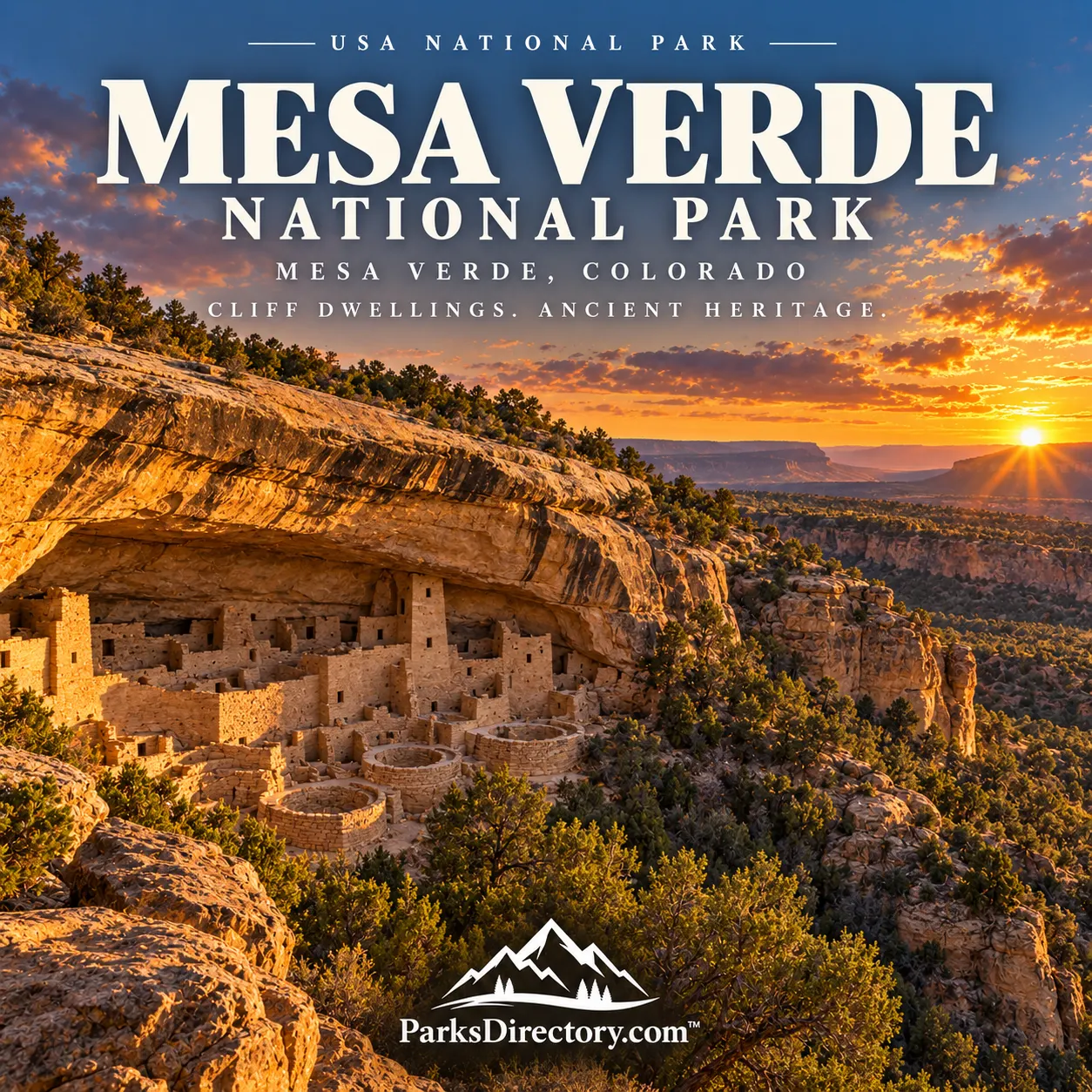
Mesa Verde National Park: Cliff Dwellings, Ancestral Pueblo History, and a Living Legacy
ParksDirectory.com™ | National Park Summary & History
A national park centered on human achievement
Mesa Verde National Park protects one of America’s most compelling cultural landscapes. Stone rooms and towers occupy sheltered sandstone alcoves, while the mesa tops preserve evidence of earlier villages, farming, and community life. The famous cliff dwellings are not isolated architectural curiosities. They belong to a much wider history of people making homes, raising families, and adapting to the conditions of the Colorado Plateau.[1][2]
The park lies in Montezuma County in southwestern Colorado, near Cortez and the Four Corners region. The National Park Service’s geological overview gives an area of approximately 52,485 acres, about 82 square miles. Its protected landscape includes thousands of archaeological sites and roughly 600 cliff dwellings. The mailing location “Mesa Verde, Colorado” identifies the park, not a separate metropolitan gateway.[1:1]
When the park was created
Mesa Verde National Park was established on June 29, 1906, when President Theodore Roosevelt signed the congressional legislation. Its central purpose was the protection of cultural remains, making it a landmark in the development of national parks devoted to human history as well as natural scenery.[3]
The date also places Mesa Verde within an important period of federal preservation policy. The Antiquities Act became law earlier that month, but Mesa Verde’s national-park establishment came through its own legislation. The distinction matters because a national monument proclaimed under presidential authority and a national park established by Congress are not the same historical event.[3:1]
In 1978, Mesa Verde received World Heritage recognition. That designation acknowledged the international importance of its cultural record, but the place’s deepest significance remains with descendant communities whose histories connect them to the people who built here.[3:2][4]
A landscape shaped for both shelter and farming
Mesa Verde is often translated as “green table,” although geologists describe the tilted upland more precisely as a cuesta. Canyons dissect the landscape, and sandstone cliffs contain the alcoves that later sheltered dwellings. Geology supplied both the physical setting and many of the materials used in construction.[5]
The elevated plateau also supported farming and a varied plant community. Pinyon-juniper woodland, grasses, and shrubs provided resources beyond cultivated crops. For residents, the surrounding land was not merely a dramatic view from a stone doorway. It supplied food, fuel, tools, medicines, and routes connecting one settlement with another.[6][7]
This relationship between buildings and their environment is essential to understanding the park. An alcove explains shelter, but the mesa above helps explain how a community could sustain itself. Looking only at the cliff faces leaves much of the human story out of sight.
Centuries before the famous cliff dwellings
Ancestral Pueblo communities lived in the Mesa Verde area from approximately 550 to 1300 CE. Early homes included pithouses built partly below the ground. Over time, architectural traditions changed, with larger masonry pueblos developing on the mesa tops. The famous alcove villages represent a relatively late part of this long sequence.[2:1]
Corn, beans, and squash were important crops, supplemented by wild foods and hunting. Storage, water management, and cooperation helped communities respond to a demanding environment. Pottery, basketry, buildings, and other surviving materials reveal technical knowledge and artistic traditions rather than a simple struggle for survival.[8]
The development was not a straight march toward a single perfect building style. Different forms suited different circumstances. A careful visit follows that variation, recognizing that a small pithouse and a monumental cliff dwelling can be equally important evidence of how people organized their lives.[2:2][9]
Cliff Palace and the architecture of community
Cliff Palace is Mesa Verde’s most recognizable landmark. With at least 150 rooms, it presents a dense arrangement of masonry, open spaces, and ceremonial architecture beneath a broad overhang. Its scale suggests functions beyond a collection of unrelated households, although interpretation depends on archaeological evidence and Pueblo knowledge rather than a complete written record left by the builders.[10]
The most revealing details are often practical ones. Retaining walls created usable surfaces on sloping rock. Paths connected villages with water sources, fields, and storage places. The design reflects the demands of everyday movement as well as a strong architectural tradition.[10:1]
Balcony House, Long House, and other well-known sites expand the picture by showing different arrangements within different alcoves. Their importance is not that every dwelling looks alike, but that related communities adapted shared knowledge to particular settings. Visiting more than one site can therefore reveal variation that a single iconic photograph obscures.[2:3]
Migration rather than disappearance
By the end of the thirteenth century, residents had moved away from Mesa Verde’s villages. Drought, pressure on resources, and social circumstances are among the factors researchers consider, but no single explanation fully accounts for every community’s decisions. A responsible history does not present migration as a solved mystery with one dramatic cause.[10:2]
Nor did the people simply vanish. Descendants live in Pueblo communities, and the park recognizes its connections with 27 Pueblos and Tribes. Oral histories, cultural practices, and return visits maintain relationships with ancestral places. The buildings may no longer be occupied as homes, but the landscape is not culturally abandoned.[4:1][11]
The campaign for protection
By the late nineteenth century, growing outside interest brought both documentation and damage to the sites. Collecting and poorly controlled excavation threatened the evidence that made the area significant. Preservation advocates sought stronger protection before more objects and archaeological context were lost.[3:3]
The Colorado Cliff Dwellings Association, led by Virginia McClurg and Lucy Peabody, organized an influential campaign beginning in 1900. Letters, fundraising, publicity, and visits helped build support. National-park establishment in 1906 followed years of advocacy rather than a sudden discovery of the cliff dwellings’ importance.[3:4]
That preservation story should sit alongside, not replace, Indigenous history. Federal designation changed legal protection and management, but it did not create the cultural value of the place. The relationship between archaeological conservation and descendant perspectives remains fundamental to interpreting Mesa Verde today.[4:2][11:1]
Reading the park as a whole
The Mesa Top Loop provides a useful introduction to the long architectural sequence, with early homes, pueblos, and overlooks toward cliff dwellings. It helps visitors resist the temptation to begin and end the park’s history with Cliff Palace. The broader landscape reveals centuries of development around the better-known final villages.[9:1]
Mesa Verde is most famous for its cliff dwellings, but its greatest contribution is the opportunity to connect architecture with people, land, and continuing memory. Approached respectfully, it is not a frozen scene of a lost civilization. It is an ancestral homeland where surviving structures invite a deeper understanding of communities whose descendants remain part of the American Southwest.[4:3][11:2]
Sources
Research reviewed September 6, 2026. Area follows the NPS geodiversity overview; square miles are rounded. Dates for Ancestral Pueblo residence are approximate. Migration is not described as disappearance, and uncertain causes are identified as interpretations rather than settled fact.
National Park Service, “NPS Geodiversity Atlas—Mesa Verde National Park, Colorado.” https://www.nps.gov/articles/nps-geodiversity-atlas-mesa-verde-national-park-colorado.htm ↩︎ ↩︎
National Park Service, “Places.” https://www.nps.gov/meve/learn/historyculture/places.htm ↩︎ ↩︎ ↩︎ ↩︎
National Park Service, “Histories of Mesa Verde.” https://www.nps.gov/meve/learn/historyculture/stories.htm ↩︎ ↩︎ ↩︎ ↩︎ ↩︎
National Park Service, “Mesa Verde National Park: World Heritage Site.” https://www.nps.gov/articles/000/mesa-verde-national-park-colorado.htm ↩︎ ↩︎ ↩︎ ↩︎
National Park Service, “Natural Features & Ecosystems.” https://www.nps.gov/meve/learn/nature/naturalfeaturesandecosystems.htm ↩︎
National Park Service, “Plants.” https://www.nps.gov/meve/learn/nature/plants.htm ↩︎
National Park Service, “Navajo Canyon View.” https://www.nps.gov/places/navajo-canyon-view.htm ↩︎
National Park Service, “Colorado: Mesa Verde National Park.” https://www.nps.gov/articles/mesaverde.htm ↩︎
National Park Service, “Explore the Mesa Top Loop Road.” https://www.nps.gov/thingstodo/ttd_mesa-top-loop-road.htm ↩︎ ↩︎
National Park Service, “Virtual Mesa Top Loop Drive.” https://www.nps.gov/meve/learn/kidsyouth/jr-mtl-online.htm ↩︎ ↩︎ ↩︎
National Park Service, “Footprints of Our Ancestors.” https://www.nps.gov/meve/learn/footprints-of-our-ancestors.htm ↩︎ ↩︎ ↩︎