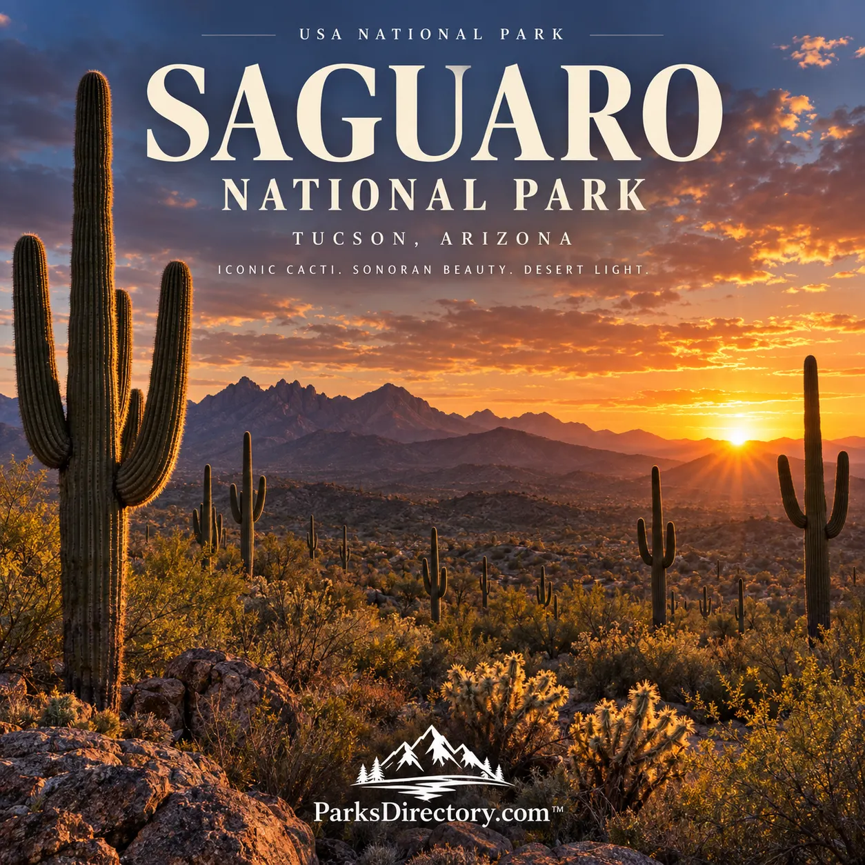
Saguaro National Park: Summary, History, and the Living Sonoran Desert
ParksDirectory.com™ | National Park Summary & History
Saguaro National Park introduces the American Southwest through a living landmark: the great branching cactus. Around Tucson, Arizona, saguaros stand above desert shrubs and rocky slopes, forming a landscape immediately recognizable even to travelers who have never visited the region. Yet the park is not simply a collection of unusually large plants. Its two districts connect desert valleys with mountain country, while archaeological sites and continuing Indigenous traditions reveal a human history much older than federal protection.[1][2]
Location and total area
The park occupies two separate areas on opposite sides of Tucson. The Rincon Mountain District lies east of the city, while the Tucson Mountain District lies west. Tucson is therefore the principal gateway rather than a town beside a single continuous park. A National Park Service overview published in 2023 describes the protected landscape as more than 94,000 acres, or approximately 147 square miles. This rounded figure describes the two park districts together; published totals differ with reporting date and boundary accounting.[3][4]
The distinction between districts matters on the ground. The western unit offers extensive cactus-covered hills, while the eastern district climbs into the Rincon Mountains. Higher elevations support woodland and forest rather than an uninterrupted cactus landscape. The surrounding urban area makes the park an especially clear example of protected habitats existing beside a growing city.[3:1][5]
When Saguaro became a park
President Herbert Hoover proclaimed Saguaro National Monument on March 1, 1933. The designation followed efforts by scientists and local supporters who recognized the significance of the region’s cactus communities. University of Arizona president Homer Shantz was among those advocating protection. The original monument focused on the eastern landscape rather than today’s two-district arrangement.[6]
On November 15, 1961, the Tucson Mountain District was added, incorporating land formerly within Pima County’s Tucson Mountain Park. Congress subsequently established Saguaro National Park on October 14, 1994, replacing the national-monument designation. Thus, 1933 marks the beginning of federal monument protection, while 1994 is the national park’s establishment date. Recognizing both dates explains why the landscape’s conservation history is much longer than its national-park title suggests.[2:1][7]
A cultural landscape, not an empty desert
Archaeological evidence documents occupation during the Archaic and Hohokam periods. People farmed, gathered plants, hunted, and moved through the desert long before modern Tucson developed. At Signal Hill, petroglyphs remain visible on darkened rock surfaces. Most park rock art is associated with the Hohokam period, although the precise meanings of individual designs should not be guessed from their appearance.[8]
The Tohono O’odham Nation maintains living connections with this country, including traditional harvesting of saguaro fruit and other plants. A National Park Service environmental review finalized in 2025 addressed traditional harvesting within the park. This continuing relationship is important: Indigenous history here is not confined to archaeological remains or interpreted as a culture that disappeared when a protected boundary was drawn.[9]
The cactus that defines the park
The saguaro is adapted to the Sonoran Desert’s demanding conditions, but its imposing size takes a long time to develop. Young plants grow slowly, and mature individuals may live for well over a century. Their familiar arms do not appear according to a universal timetable; growth and branching vary with local conditions. A tall, many-branched cactus therefore records a long relationship between a plant, its site, and changing weather.[10]
Late spring and early summer bring another transformation as blossoms appear near growing tips. Flowers, fruit, and seeds connect the cactus to animals and people, making the plant an ecological participant rather than a solitary desert ornament. The park’s flowering observations also contribute to research on seasonal timing, allowing a conspicuous annual event to become a source of scientific information.[11]
The best-known sights
In the Tucson Mountain District, Signal Hill combines a concentrated cultural site with the broader setting of desert hills. Its petroglyphs are incised or pecked into rock, often exposing lighter material beneath a dark surface coating. The site rewards close observation without requiring visitors to invent a translation for every spiral or geometric figure. Its value lies partly in the reminder that this seemingly sparse country has long been meaningful and inhabited.[8:1]
The Bajada Loop landscape reveals another side of the western district: exposed rocks, cactus stands, and slopes that display the desert’s geological structure. The eastern district’s Cactus Forest and the rising Rincon Mountains provide a different perspective. Here the protected setting extends from the plants that first inspired preservation into a much broader mountain ecosystem. Seeing both districts helps explain why a single photograph of cactus silhouettes cannot summarize the whole park.[12][5:1]
Mountain wilderness beyond the familiar view
The Rincon backcountry is one of Saguaro’s less obvious defining features. Congress designated wilderness here in 1976, before the monument became a national park. Forested mountain slopes and roadless terrain contrast sharply with the urban basin below. The park’s wilderness also adjoins separately managed wilderness in Coronado National Forest; those neighboring acres should not be added to the park’s acreage as though they were the same unit.[13]
This elevation range changes the way to understand Saguaro. Desert conservation is not merely about preserving heat-tolerant plants at low elevations. It also involves maintaining connections among habitats, with cooler mountain conditions close to the much hotter basin. The progression from cactus to woodland and pine forest is one of the park’s most memorable contrasts.[5:2]
Research, fire, and a changing landscape
Long-term monitoring gives the park unusual scientific importance. The modern saguaro census has been repeated at ten-year intervals since 1990, building on older research. The 2020 census showed why total abundance alone is an incomplete measure of health: some study plots gained plants while others lost them, and the establishment of young saguaros remained a concern. A mature cactus forest can look stable even while its future age structure changes.[14]
Invasive buffelgrass creates a different challenge. It can fill spaces between native desert plants and carry fires through vegetation poorly adapted to that fire regime. Management therefore includes controlling the grass and restoring affected areas. This is distinct from assuming that all fire is inherently harmful across every elevation of the park. Different ecosystems require different approaches.[15]
Why Saguaro matters
Saguaro’s enduring appeal comes from the relationship between an unmistakable plant and a surprisingly varied landscape. Its history links local advocacy, national legislation, continuing Indigenous traditions, and long-term ecological observation. The most rewarding overview holds these elements together: a park created to protect exceptional cactus country now preserves desert, mountain wilderness, cultural places, and a changing natural community at Tucson’s doorstep.[6:1][9:1][13:1]
Sources
Research checked September 6, 2026. Area is a rounded NPS overview figure, not a cadastral survey. Historical milestones are distinguished from later boundary changes.
National Park Service, “Saguaro National Park.” https://www.nps.gov/sagu/ ↩︎
National Park Service, “History & Culture.” https://www.nps.gov/sagu/learn/historyculture/index.htm ↩︎ ↩︎
National Park Service, “Plan Your Visit.” https://www.nps.gov/sagu/planyourvisit/index.htm ↩︎ ↩︎
National Park Service, “Saguaro National Park Becomes World’s Ninth Urban Night Sky Place,” November 13, 2023. https://www.nps.gov/sagu/learn/news/2023-11-13_https-www-nps-gov-sagu-learn-news-2023-11-13_urban-night-sky-place-announcement-htm.htm ↩︎
National Park Service, “Outdoor Activities.” https://www.nps.gov/sagu/planyourvisit/outdooractivities.htm ↩︎ ↩︎ ↩︎
National Park Service, “The Beginning of Saguaro National Park.” https://www.nps.gov/sagu/planyourvisit/snp-history.htm ↩︎ ↩︎
United States Code, 16 USC 410zz-1, establishment under Public Law 103-364, October 14, 1994. https://uscode.house.gov/view.xhtml?req=granuleid:USC-prelim-title16-section410zz-1&num=0&edition=prelim ↩︎
National Park Service, “Petroglyphs.” https://www.nps.gov/sagu/learn/historyculture/petroglyphs.htm ↩︎ ↩︎
National Park Service, “Environmental Assessment Finalized for Traditional Tohono O’odham Nation Plant Material Harvesting.” https://www.nps.gov/sagu/learn/news/environmental-assessment-finalized-for-traditional-tohono-o-odham-nation-plant-material-harvesting.htm ↩︎ ↩︎
National Park Service, “Saguaro.” https://www.nps.gov/sagu/learn/nature/saguaro.htm ↩︎
National Park Service, “Saguaro Flower Power Project.” https://www.nps.gov/sagu/getinvolved/saguaro-flower-power-project.htm ↩︎
National Park Service, “Geology.” https://www.nps.gov/sagu/learn/nature/geology.htm ↩︎
National Park Service, “Saguaro Wilderness Area” and “Camping.” https://www.nps.gov/sagu/learn/nature/saguaro-wilderness-area.htm ; https://www.nps.gov/sagu/planyourvisit/camping.htm ↩︎ ↩︎
National Park Service, “2020 Saguaro Census Final Report.” https://www.nps.gov/sagu/learn/nature/2020-saguaro-census-final-report.htm ↩︎
National Park Service, “Managing Invasives & Landscape Restoration.” https://www.nps.gov/sagu/getinvolved/managing-invasives-landscape-restoration.htm ↩︎