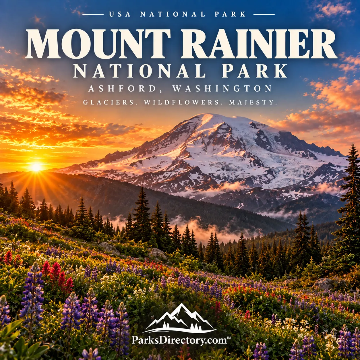
Mount Rainier National Park: A Glaciated Volcano and the Making of a Mountain Park
ParksDirectory.com™ | National Park Summary & History
A mountain that defines its region
Mount Rainier rises above western Washington as both a familiar regional landmark and an immense protected mountain environment. Its summit reaches 14,410 feet, and glaciers spread across the slopes of an active volcano. Below the ice, wildflower meadows, river valleys, and old forests create a striking vertical sequence of habitats. Few American parks make the relationship between elevation and landscape so immediately visible.[1]
The park occupies the western Cascade Range in west-central Washington, southeast of the Seattle–Tacoma metropolitan area. Ashford is an important southwestern gateway, not the location of the entire park. The National Park Service’s press kit lists 236,381 acres within the authorized park boundary, approximately 369 square miles. It separately identifies property outside that boundary near the Carbon River entrance; that additional property is not included in the figure used here.[2]
When Mount Rainier became a national park
Mount Rainier National Park was established on March 2, 1899, when President William McKinley signed its enabling legislation. It became the nation’s fifth national park. The designation protected a landscape already attracting scientists, mountaineers, conservation advocates, and visitors interested in its forests and dramatic alpine scenery.[3]
Its creation is an important chapter in the early national-park movement. Here, protection extended beyond a spectacular summit to the environments surrounding it. Meadows, forests, glaciers, and watersheds were essential parts of the mountain’s value. That broader understanding remains useful when interpreting the park: Rainier is not simply a peak with recreational land around its base.[3:1][4]
The establishment date should not be confused with the creation of the National Park Service in 1916. Mount Rainier existed as a national park before that agency began coordinating the federal park system.[5]
An Indigenous homeland long before 1899
The mountain and its surrounding country have enduring cultural importance for Indigenous peoples, including the Cowlitz, Muckleshoot, Nisqually, Puyallup, Squaxin Island, and Yakama. The park’s account of associated Tribes describes historical, spiritual, and continuing relationships with this landscape. Names such as Takhóma express connections that predate the English name Mount Rainier.[6]
Mountain environments provided gathering places, travel routes, and culturally important resources. Seasonal use of higher elevations was part of a wider regional geography rather than evidence that the mountain country was uninhabited. Visitors should therefore understand the national park as a later legal designation placed over an existing homeland.[6:1]
The first recorded successful summit ascent by outside climbers occurred in 1870, when Hazard Stevens and P. B. Van Trump reached the top. Their journey depended in part on Sluiskin, an Indigenous guide who led them toward the mountain and their camp near Paradise. The story is more complete when his contribution accompanies the climbers’ names.[5:1]
A volcano shaped by ice
Mount Rainier’s distinguishing feature is the combination of volcanic construction and glacial erosion. Eruptions built the mountain, while moving ice carved and rearranged its surface. Glaciers continue to transport rock, feed rivers, and influence the shape of the valleys below. The landscape is therefore active even when the volcano is not erupting.[7]
Rainier is the most heavily glaciated peak in the contiguous United States. Its ice is also a valuable environmental record. Changes in glacier position and volume reveal how mountain systems respond to climate, and those changes affect water, sediment, and habitats downstream. A distant white slope is consequently much more than a scenic backdrop.[1:1][7:1]
The active-volcano designation also matters. Appreciating the mountain includes recognizing that volcanic processes, steep terrain, and shifting ice help define it. The national park preserves a dynamic geological system rather than a permanently fixed postcard scene.[1:2][7:2]
Longmire and the beginnings of park tourism
James Longmire encountered mineral springs during an 1883 visit after climbing the mountain. He subsequently developed accommodations and a health-oriented resort near the springs. The place that carries his name became an early center of visitor activity and, after national-park establishment, park administration.[5:2]
Longmire’s surviving buildings help make that transition visible. The area combines early tourism history with the development of the federal park system. A former headquarters building now serves as a museum, allowing visitors to connect the landscape with the people who interpreted, maintained, and managed it.[8]
This is a useful counterpoint to the high-country scenery. National parks are often imagined as places outside human history, yet roads, hotels, ranger facilities, and administrative decisions have strongly influenced how visitors encounter them. At Longmire, those choices remain part of the landscape.[8:1]
Paradise and the mountain meadows
Paradise is among Mount Rainier’s best-known locations. Its subalpine setting offers views toward the mountain and a celebrated seasonal display of wildflowers. The meadows form a transition between forest and the colder, more exposed country above, making them an especially accessible introduction to the park’s ecological variety.[9]
The name can encourage an expectation of effortless scenery, but the meadows are living communities shaped by snow cover, short growing seasons, and heavy visitation. Their appeal depends on the same conditions that make them vulnerable. Understanding that relationship adds meaning to the familiar views of flowers beneath the mountain.[9:1]
Paradise also connects natural and architectural history. The park’s historic developed areas reflect deliberate efforts to place visitor facilities within a mountain setting without allowing the buildings to dominate the scenery.[10]
Sunrise and a different perspective
On the northeastern side, Sunrise offers another distinctive view of Rainier and its alpine surroundings. The open country emphasizes ridges, glaciers, and broad mountain distances. Seen from this side, the peak can feel different from the familiar southwestern approach, illustrating how strongly perspective changes the experience of a single mountain.[11]
That contrast is one reason the park rewards being understood as a whole. Forested valleys, developed historic districts, wildflower slopes, and exposed uplands are related parts of one protected area, but they do not tell identical stories. Each reveals a different scale of the mountain environment.[1:3][11:1]
A landmark in national-park design
Mount Rainier also helped shape the design of American national parks. Its late-1920s master plan was among the earliest comprehensive plans developed and implemented for a national park. Roads, trails, buildings, and scenic experiences were considered together rather than treated as unrelated projects.[10:1]
The resulting historic landmark district preserves evidence of that approach, including the use of rustic architecture and carefully organized visitor areas. Rainier is therefore notable not only for what nature created but for its influence on how the park system presented protected landscapes to the public.[10:2]
Mount Rainier’s enduring identity comes from that combination: an Indigenous homeland, an active glaciated volcano, a pioneering national park, and a setting where forests and meadows remain as important as the summit. Its history invites visitors to look beyond the mountain’s outline and see the many relationships gathered beneath it.
Sources
Research checked September 6, 2026. Acreage follows the NPS press kit’s authorized-boundary definition; square miles are rounded. This historical overview does not establish current road, trail, or facility availability.
National Park Service, “Mount Rainier National Park.” https://www.nps.gov/mora/index.htm ↩︎ ↩︎ ↩︎ ↩︎
National Park Service, “Press Kit.” https://www.nps.gov/mora/learn/news/presskit.htm ↩︎
National Park Service, “The Fifth National Park.” https://www.nps.gov/mora/learn/management/fifth-park.htm ↩︎ ↩︎
National Park Service, “What’s Special About Mount Rainier?” https://www.nps.gov/mora/learn/management/what-s-special.htm ↩︎
National Park Service, “Mount Rainier History.” https://www.nps.gov/mora/learn/historyculture/mount-rainier-history.htm ↩︎ ↩︎ ↩︎
National Park Service, “Associated Tribes of Mount Rainier.” https://www.nps.gov/mora/learn/historyculture/associated-tribes-of-mount-rainier.htm ↩︎ ↩︎
National Park Service, “Glaciers.” https://www.nps.gov/mora/learn/nature/glaciers.htm ↩︎ ↩︎ ↩︎
National Park Service, “Longmire.” https://www.nps.gov/places/longmire.htm ↩︎ ↩︎
National Park Service, “Paradise.” https://www.nps.gov/mora/planyourvisit/paradise.htm ↩︎ ↩︎
National Park Service, “Mount Rainier Historic Landmark District.” https://www.nps.gov/mora/learn/historyculture/mount-rainier-historic-landmark-district.htm ↩︎ ↩︎ ↩︎
National Park Service, “Sunrise.” https://www.nps.gov/mora/planyourvisit/sunrise.htm ↩︎ ↩︎