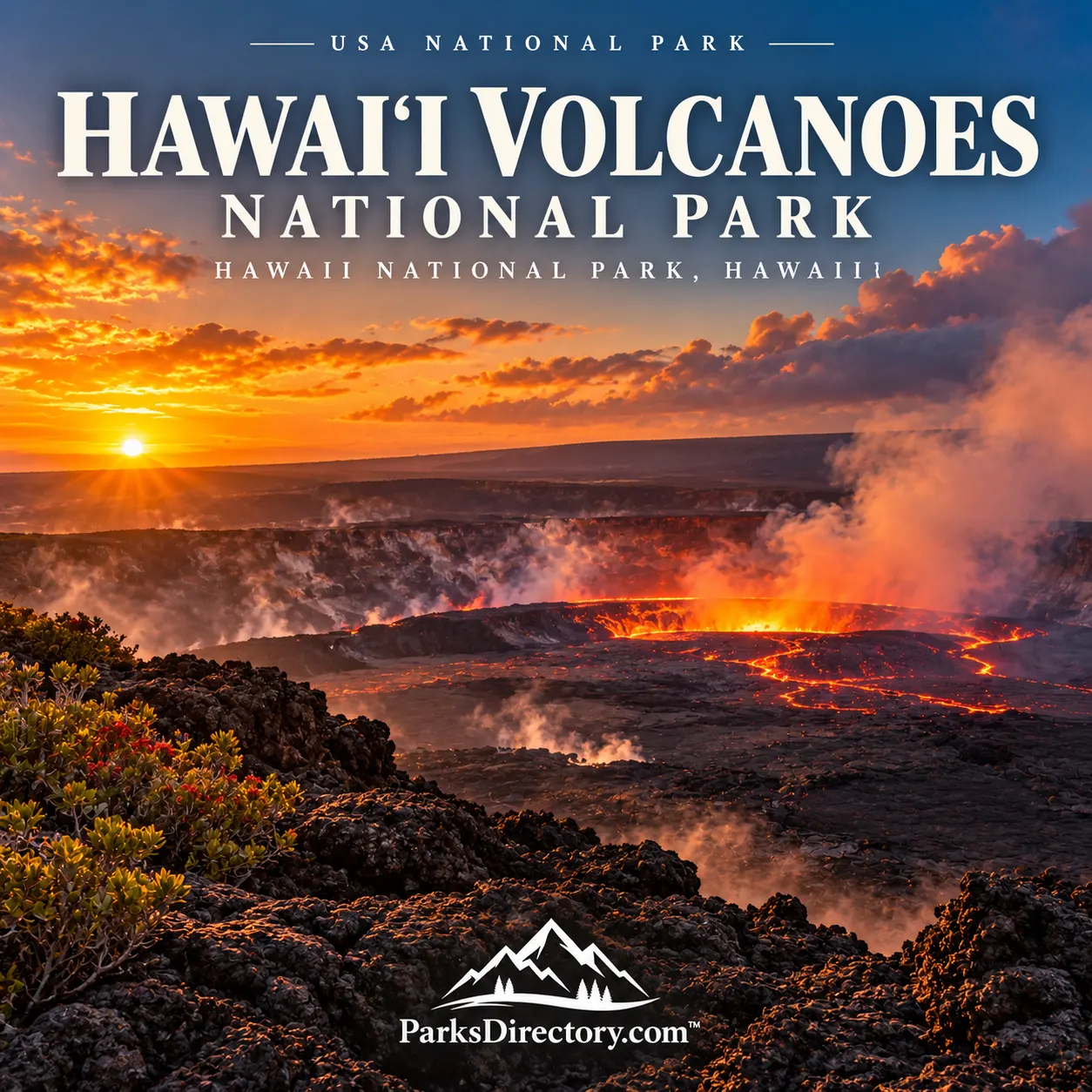
Hawaiʻi Volcanoes National Park

Hawaii National Park, Hawaii · Hawaii outdoor places

Hawaiʻi Volcanoes National Park

History

Hawaiʻi Volcanoes National Park: Living Volcanoes and an Island’s Cultural Foundations

ParksDirectory.com™ | National Park Summary & History

Location, size, and establishment

Hawaiʻi Volcanoes National Park occupies the southeastern part of Hawaiʻi Island, protecting the summits and portions of the slopes and rift zones of Kīlauea and Mauna Loa. Its address, Hawaii National Park, refers to the park’s postal locality rather than a separate island or city. The National Park Service’s fact sheet reports 354,461 acres, approximately 554 square miles, ranging from the coast to Mauna Loa’s high summit.[1]

The park was established on August 1, 1916, as Hawaii National Park. That original unit also included Haleakalā on Maui. Haleakalā became a separate park in July 1961, and legislation approved on September 22, 1961, gave the Hawaiʻi Island unit its Hawaiʻi Volcanoes name. The 1916 date remains its original establishment date, not 1961.[1:1][2]

It is best known for active volcanic landscapes, immense craters, lava flows and tubes, native forests, and Hawaiian cultural places. Unlike a park whose principal scenery changes almost imperceptibly, this one can undergo dramatic physical transformation within a visitor’s lifetime.

A sacred landscape before federal protection

Native Hawaiians lived, traveled, cultivated, worshipped, and maintained relationships with these lands for centuries before the national park existed. Archaeological places, oral traditions, and continuing cultural practice make the volcanoes inseparable from Hawaiian history. The park is not simply an outdoor geological laboratory with a cultural story attached afterward.[3]

Pelehonuamea, commonly called Pele, is central to that understanding. In Hawaiian tradition, she is the volcano deity and a creative as well as destructive force. Halemaʻumaʻu at Kīlauea’s summit is identified as her home. For many Hawaiians, these are living relationships involving reverence and family connection, not remote beliefs preserved only in museums.[4]

That perspective changes how the landscape is experienced. New lava can erase roads and familiar viewpoints while also creating land. Approaching the park respectfully means recognizing both the practical hazards of an active volcano and the significance of the place to people whose connections long predate federal management.[4:1]

Science, tourism, and the creation of a park

The nineteenth and early twentieth centuries brought increasing outside attention to Hawaiʻi’s volcanoes. Travelers, artists, scientists, and writers described scenes that differed dramatically from familiar mainland landscapes. Their work helped establish the volcanoes as internationally recognizable destinations, although it did not amount to their discovery.[5]

The park’s establishment also depended on Hawaiian political advocacy. Congressional delegate Prince Jonah Kūhiō Kalanianaʻole introduced legislation for what became Hawaii National Park. His role belongs alongside those of scientific and promotional figures when explaining how federal protection was achieved.[5:1]

The broader institutional history includes labor as well as celebrated advocates. Buffalo Soldiers of the U.S. Army’s 25th Infantry worked in the area during the years around establishment. Later, the Civilian Conservation Corps contributed to park development. Roads, trails, buildings, and interpretive facilities made the volcanic landscape more accessible, while also changing the ways people moved through it.[5:2]

Not every historical chapter is celebratory. The park also preserves accounts of Japanese residents detained at Kīlauea Military Camp during World War II. These experiences complicate an account limited to scenic tourism and scientific achievement.[5:3]

Two volcanoes, different scales

Kīlauea is the younger volcano and the focus of many familiar park experiences. Its summit, craters, and rift zones demonstrate that volcanic activity is distributed through a connected system rather than confined to a single cone. The visible landscape records repeated episodes of eruption, collapse, and renewed construction.[6]

Mauna Loa is vastly broader. Its gentle-looking profile can disguise the immense volume of the mountain, which rises from the ocean floor as well as above sea level. The park protects high, exposed terrain on this volcano in addition to the more frequently photographed landscapes around Kīlauea.[6:1]

The volcanoes are part of the process that built the Hawaiian chain. Their flows produce contrasting forms, including smoother pāhoehoe and rougher ʻaʻā surfaces, while gases, fractures, craters, and older deposits reveal other aspects of volcanic behavior. The park’s diversity comes from these interacting processes, not solely from the sight of molten lava.[1:2][6:2]

Eruptions as chapters of history

The park’s eruption record offers a sequence of dramatically different events. The 1924 explosions at Kīlauea demonstrate that Hawaiian volcanic activity is not always a gentle flow. The 1959 Kīlauea Iki eruption produced a lava lake and spectacular fountains, leaving a landscape that became one of the park’s best-known settings.[7]

The long Maunaulu eruption of 1969–1974 altered another part of the park, while later activity repeatedly reshaped Kīlauea’s summit and rift zones. These episodes help explain why old photographs and maps can show places that no longer look the same. A national park can preserve a natural process even when that process destroys particular landmarks.[7:1]

Accordingly, a summary of the park should distinguish enduring significance from current viewing conditions. Lava visibility, safe access, and the condition of individual sites vary. The attraction is the opportunity to understand an active volcanic system, not a promise that a particular eruption will be visible during every visit.[7:2]

Forests, wildlife, and cultural places

Beyond the stark lava lies an exceptional biological landscape. Elevation and exposure create coastal, woodland, rain-forest, subalpine, and alpine environments. Native species occupy habitats ranging from relatively sheltered forests to demanding volcanic slopes. The park’s conservation purpose includes this ecological variety as explicitly as it includes the volcanoes.[1:3]

Island isolation encouraged the evolution of plants and animals found nowhere else. That same history makes many species vulnerable to introduced predators, grazing animals, invasive plants, and disease. Protecting Hawaiian ecosystems requires restoration and sustained management; a line on a map cannot by itself prevent those pressures.[8]

Cultural sites provide another essential layer. Coastal and upland places preserve evidence of Hawaiian occupation, movement, ceremony, and later ranching. The Kahuku-Pōhue lands illustrate the broadening of the park’s protection to include additional coastal habitats and cultural resources, rather than only the most famous summit scenery.[3:1]

Why Hawaiʻi Volcanoes matters

Few national parks make the relationship between destruction and creation so immediate. Craters enlarge, lava cools, vegetation returns, and cultural relationships continue through physical change. Scientific observation and Hawaiian knowledge illuminate different dimensions of this landscape without making either expendable.[3:2][4:2][6:3]

Its establishment history also shows how a park’s purpose can grow. A reserve celebrated for spectacular volcanoes has become a setting for ecosystem restoration, cultural stewardship, historical interpretation, and the study of ongoing earth processes. Its boundaries encompass a much richer story than a single glowing crater.[1:4][8:1]

For travelers, the most lasting impression may be that the island is still being made. Hawaiʻi Volcanoes offers a rare chance to connect that geological present with centuries of human meaning and a continuing responsibility to care for the land.

Sources

Research checked September 6, 2026. Acreage follows the park fact sheet updated May 15, 2025. Eruptions are discussed historically; this article does not describe current lava-viewing or access conditions.


  1. National Park Service, Hawaiʻi Volcanoes National Park Fact Sheet. ↩︎ ↩︎ ↩︎ ↩︎ ↩︎

  2. National Park Service, 1960–1961 Legislation Separating and Renaming the Parks. ↩︎

  3. National Park Service, Places. ↩︎ ↩︎ ↩︎

  4. National Park Service, Pele. ↩︎ ↩︎ ↩︎

  5. National Park Service, People. ↩︎ ↩︎ ↩︎ ↩︎

  6. National Park Service, Volcanoes. ↩︎ ↩︎ ↩︎ ↩︎

  7. National Park Service, Eruptions. ↩︎ ↩︎ ↩︎

  8. National Park Service, Nature. ↩︎ ↩︎

Travel guide

Hawaiʻi Volcanoes National Park: A Landscape Still Taking Shape

Hawaiʻi Volcanoes National Park is most rewarding when you arrive curious rather than determined to see lava. Eruptive activity is intermittent, and weather, gas conditions, or restrictions can change what is visible. Consult current park and volcano information before departure, but build an itinerary that remains worthwhile without an eruption.[1]

That is not a compromise. Crater views, rainforest, hardened lava, cultural sites, and a road descending toward the ocean create a remarkably varied experience. The park invites you to consider dramatic change and what happens afterward: surfaces weathering, plants returning, and people maintaining relationships with a dynamic landscape. A patient visit can reveal more than a brief encounter with glowing lava.

Begin with current guidance

Use the park’s available welcome facilities, maps, and alerts to orient yourself before selecting a route. Access around Kīlauea can change, and older maps may show roads or facilities that no longer function as expected. Choose an open area appropriate to the day’s conditions and your group’s ability.[1:1]

When volcanic activity is visible, remain within designated viewing areas and behind barriers. Gases, unstable edges, ground cracks, and falling volcanic material require respect. Increased traffic can also make a spontaneous move between viewpoints less practical than it appears.[1:2]

Confirm where toilets and services are available, what supplies must be carried, and which walks require more time than their names suggest. A calm beginning leaves more attention for the landscape than resolving those questions after entering a busy viewing area.

Walk the story of Kīlauea Iki

The Kīlauea Iki hike descends through rainforest to the solidified lava lake formed during the 1959 eruption. The contrast between enclosed forest and open crater floor is one of the park’s distinctive walking experiences. Steep and rocky sections make it more than a casual flat stroll.[2]

Select the trailhead carefully. Different starting points produce different total distances, and parking at the overlook can be limited. Do not copy the mileage for one route and begin at another without accounting for the extra walking.[2:1]

Carry food, water, rain protection, and footwear suitable for uneven ground. On the crater floor, notice textures, cracks, and returning plants from the established route. Leave rocks untouched and do not build cairns, which can confuse navigation and disrespect the cultural setting.

Enter Nāhuku with care

Nāhuku, also called Thurston Lava Tube, combines a rainforest approach with passage through a former lava conduit. It offers another way to imagine volcanic processes: an enclosed space through which molten rock once moved rather than a distant crater view.[3]

Low ceilings, uneven footing, and wet surfaces require careful movement. Check access and lighting information before visiting, especially outside ordinary daytime conditions. Give other visitors room instead of hurrying through a narrow passage.

Avoid touching walls or hanging roots. Past souvenir collecting damaged features, demonstrating how small actions can permanently alter a shared place. Take photographs and observations rather than objects. A quiet pause can make the passage more memorable than simply moving from entrance to exit.

Follow Chain of Craters Road

Chain of Craters Road descends through volcanic terrain toward the ocean. Lava flows have repeatedly changed its history and the surrounding landscape. The coast also contains a deeper human story, including villages, trails, agricultural areas, and cultural sites that supported complex patterns of life.[4]

Bring the supplies required for the whole outing. The park identifies no food, water, or fuel along the road, and communication is limited. Treat the drive as a dedicated excursion rather than a quick extension after an already tiring hike.[4:1]

Choose several stops to explore attentively instead of stopping mechanically at every pullout. Read interpretation and notice differences in rock surfaces. Leave time for the return uphill, stay away from unstable coastal edges, and obey all closures even when the terrain beyond them looks inviting.

Include Hawaiian cultural meaning

These landscapes are not simply geological exhibits. They hold continuing significance for Native Hawaiians, and cultural interpretation is essential to understanding the park. Approach viewpoints and trails with the respect you would bring to other sacred and historically important places.[1:3]

The Puʻuloa petroglyph walk, when open and suitable for conditions, offers an opportunity to consider human connections to this terrain. Stay on the designated viewing route, never touch or trace carvings, and avoid placing objects on the rock.[5]

Ask questions beyond the age of a lava flow. How do people understand, use, and care for the land? Listening to those perspectives connects the landscape’s physical drama with cultural depth and makes the visit more than a sequence of natural wonders.

Consider Kahuku as a separate outing

Kahuku lies away from the main Kīlauea visitor area and introduces surroundings shaped by both volcanism and ranching. Its walks include grassy landscapes, cinder-cone views, and evidence of earlier land use. Verify opening days, road conditions, and available trails before making the journey.[6]

This is an option for travelers with additional time, not another district to squeeze into an overcrowded afternoon. Carry drinking water and other supplies because potable water is not provided. Follow any footwear-cleaning or disease-prevention instructions at trail access points.[6:1]

Choose one route that suits the available time and allow yourself to appreciate its different atmosphere. After the main park’s crater scenery, the quieter contrasts may become an unexpected highlight rather than a secondary attraction.

Prepare for different environments

The same visit may involve exposed lava, wet forest, wind, and an evening outdoors. Pack layers and organize essential supplies so they can be reached without repeatedly emptying a bag. Comfortable footwear is particularly important when several short walks add up to a substantial day.

Check air-quality and weather guidance, especially when someone in the group has relevant health concerns. Do not enter closed ground for a closer view or treat a photograph from another day as evidence that current conditions are safe.[1:4]

Keep meals and rest deliberate. A simple packed lunch allows you to pause where appropriate instead of leaving an interesting area solely to find food. An unrushed schedule also makes it easier to change plans when a road, trail, or viewing location is unavailable.

A suggested two-day introduction

Use the first day for orientation, available caldera viewpoints, and either Kīlauea Iki or a shorter walk such as Devastation Trail. Add Nāhuku only when the total walking and parking arrangements remain comfortable. Keep any evening eruption viewing conditional rather than the definition of a successful day.[5:1]

Dedicate the second day to Chain of Craters Road, with interpretation and an appropriate short walk. Travelers staying longer can give Kahuku its own visit. The sequence should yield to current access, volcanic conditions, and the group’s needs.

Watch for nēnē around roads and parking areas and never feed them.[4:2] Leave natural and cultural objects where they belong. The strongest visit to Hawaiʻi Volcanoes creates a sense of process rather than one spectacle. Whether lava is visible or absent, the landscape remains an extraordinary place to consider creation, change, and the responsibility of visiting carefully.

Sources

Prepared September 6, 2026. Suggested itineraries are editorial recommendations. Check official park alerts, reservations, and operating information before traveling.


  1. National Park Service, Eruption Viewing and Planning. ↩︎ ↩︎ ↩︎ ↩︎ ↩︎

  2. National Park Service, Kīlauea Iki. ↩︎ ↩︎

  3. National Park Service, Nāhuku. ↩︎

  4. National Park Service, Chain of Craters Road. ↩︎ ↩︎ ↩︎

  5. National Park Service, Day Hikes. ↩︎ ↩︎

  6. National Park Service, Kahuku Unit. ↩︎ ↩︎