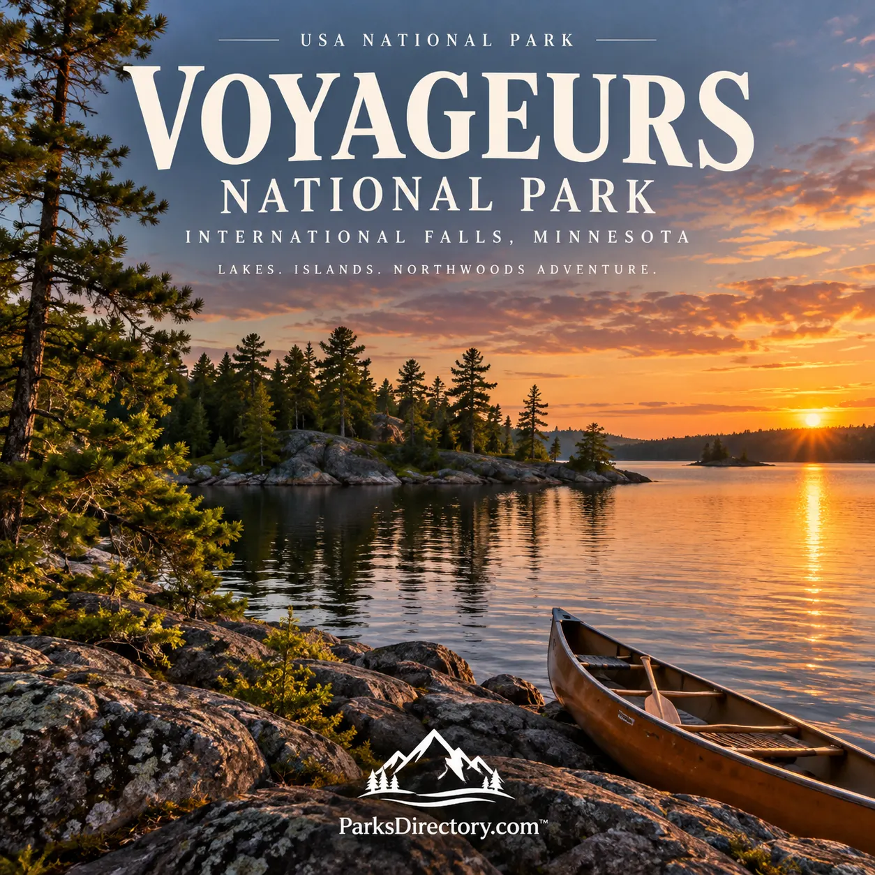
Voyageurs National Park: Summary, History, and the Northern Waterways
ParksDirectory.com™ | National Park Summary & History
A national park best understood from the water
Voyageurs National Park offers a different kind of American park landscape: broad lakes, wooded islands, exposed rock, and waterways that have connected people for thousands of years. Located in northern Minnesota along the Canadian border, it is closely associated with International Falls and the region’s lake communities. Here, water is not simply an attraction beside the scenery. It organizes the geography and provides the historic routes through which the landscape has been known, inhabited, and explored.[1][2]
The park protects approximately 218,000 acres, or about 341 square miles. That figure includes both land and water. Its identity depends on the two together: wooded shorelines frame the lakes, while peninsulas and islands divide seemingly vast expanses into channels, bays, and more intimate settings.[1:1]
Authorization in 1971, establishment in 1975
Two dates are important when describing the park’s creation. President Richard Nixon signed legislation authorizing Voyageurs National Park on January 8, 1971. The Secretary of the Interior’s order formally establishing it was published in the Federal Register on April 8, 1975. The first date records legislative authorization; the second records official establishment. They are separate steps, not competing answers to the same question.[3]
The intervening process involved land transfers and acquisition. Minnesota’s park campaign generated strong disagreement, especially over logging, hunting, local tax revenues, and federal ownership. State and local land donations helped enable establishment, while purchases of private property remained contentious for some residents. A fair history recognizes this debate rather than imagining an unoccupied landscape simply being set aside by unanimous agreement.[4]
Indigenous homelands and long-established routes
People reached the region thousands of years before the park or the fur trade. Archeological evidence reflects hunting, fishing, gathering, and later substantial use of wild rice. The National Park Service documents more than 220 pre-contact archeological sites, illustrating a long relationship between people and the waterways. Lakes and wetlands were sources of food, transportation, and settlement rather than barriers at the edge of civilization.[5]
The Bois Forte Ojibwe are especially important to the area’s more recent Indigenous history. An 1866 treaty transferred a large territory to the United States, but people continued living in and harvesting resources from their homeland. Understanding that continuity helps prevent the common mistake of presenting Indigenous history as a prologue that ended when commercial traders arrived.[4:1]
The voyageurs who gave the park its name
The park’s name commemorates the French-Canadian canoe workers who transported trade goods and furs through this northern network. Their route between Grand Portage and the distant Lake Athabasca region passed through waters now associated with the park. Paddling was only part of their work: cargo and canoes also had to be carried around obstacles along portages.[6]
This trade depended on Indigenous knowledge and labor. Ojibwe builders supplied birchbark canoes, and local people provided food and participated in commercial exchange. The voyageurs’ story is therefore not simply one of outsiders overcoming wilderness. It is also a story of interdependence, demanding physical work, and an international economy that connected northern lakes with distant markets for fur.[6:1]
Ancient rock and a landscape shaped by ice
Voyageurs exposes rocks from the ancient core of North America. Its geological story includes volcanism, deformation, heat, and the formation of igneous and metamorphic rocks. Much later, glacial ice stripped away younger material and revealed the roots of old mountain systems. Meltwater then occupied low areas, contributing to the lake-and-wetland landscape familiar today.[7]
These two timescales are easy to appreciate from the shore: very old bedrock supports a surface shaped by much younger glaciation. Some exposed greenstone is approximately 2.8 billion years old. Gold in quartz veins within ancient rocks also helped trigger a short-lived local mining boom in the 1890s, linking geological history directly to human settlement and ambition.[7:1]
The great lakes and the Kabetogama Peninsula
Rainy, Kabetogama, Namakan, and Sand Point are the four principal large lakes named in the park’s water-based visitor geography. They provide broad views, island shorelines, and routes to historic destinations. The Kabetogama Peninsula creates a contrasting interior of smaller lakes and forest. Reaching those interior waters generally involves first traveling across a larger lake and then following a trail inland.[8]
This arrangement explains why Voyageurs cannot be understood as a conventional scenic-drive park. A road can reach a mainland access point without reaching the landscape beyond it. The transition from open water to a sheltered bay or interior lake is part of the park’s defining experience, and it echoes the importance of water routes throughout its history.[8:1]
Kettle Falls and working shorelines
Kettle Falls brings several historical strands together. Indigenous travelers and fishers, fur traders, prospectors, and industrial workers all used this strategic passage. Dam construction began in the early twentieth century, and the Kettle Falls Hotel, operating since 1913, served successive generations of workers and travelers. As logging and commercial fishing declined, recreation became more prominent.[9]
Other preserved places broaden that story. At Hoist Bay, logging infrastructure and later resort development show how a working shoreline changed uses over time. Historic fish camps, cabins, and former settlements elsewhere in the park likewise challenge the idea that national parks contain only untouched nature. Voyageurs preserves evidence of livelihoods as well as the scenery that supported them.[10][2:1]
Ellsworth Rock Gardens
The Ellsworth Rock Gardens are among the park’s most unexpected landmarks. Jack Ellsworth, a Chicago carpenter and self-taught artist, created terraces, planted beds, and numerous stone sculptures on a rock outcrop overlooking Kabetogama Lake. The work developed over roughly two decades and became a recognized recreational destination.[11]
The gardens demonstrate a different relationship with northern scenery: one based on artistic arrangement rather than resource extraction. Their preservation adds an intimate human scale to the park’s expansive waters. Stone, vegetation, and lake views become parts of an intentionally composed place, not just the background to another historic building.[11:1]
Forests, wildlife, and a protected night sky
Voyageurs occupies a transition between northern hardwood and southern boreal forests. Its wetlands, woods, and waters support animals including otters, bald eagles, wolves, and sturgeon. Beavers and fire help reshape habitats, while scientific monitoring and restoration address changes in the park’s interconnected systems.[12]
In 2020, Voyageurs received International Dark Sky Park certification. That recognition added the quality of darkness to a conservation story already centered on land and water. Its lasting distinction is the combination: ancient bedrock, long-used travel routes, cultural landmarks, northern wildlife, and a night sky that remains a valued part of the protected landscape.[13]
Sources
Research checked September 6, 2026. Area is rounded from the NPS park overview. Authorization in 1971 and formal establishment in 1975 are distinguished explicitly.
National Park Service, “Voyageurs National Park.” https://www.nps.gov/voya/ ↩︎ ↩︎
National Park Service, “Places.” https://www.nps.gov/voya/learn/historyculture/places.htm ↩︎ ↩︎
National Park Service, “Park History.” https://www.nps.gov/voya/learn/management/park-history.htm ↩︎
Minnesota Historical Society, MNopedia, “Voyageurs National Park.” https://www.mnhs.org/mnopedia/search/index/place/voyageurs-national-park ↩︎ ↩︎
National Park Service, “Native American.” https://www.nps.gov/voya/learn/historyculture/nativeamerican.htm ↩︎
National Park Service, “Voyageurs.” https://www.nps.gov/voya/learn/historyculture/the-fur-trade.htm ↩︎ ↩︎
National Park Service, “Geology.” https://www.nps.gov/voya/learn/nature/geology.htm ↩︎ ↩︎
National Park Service, “Backcountry Camping and Canoes.” https://www.nps.gov/voya/planyourvisit/backcountry-camping-and-canoes.htm ↩︎ ↩︎
National Park Service, “Kettle Falls.” https://www.nps.gov/voya/learn/historyculture/kettlefalls.htm ↩︎
National Park Service, “Hoist Bay.” https://www.nps.gov/voya/learn/historyculture/hoist-bay.htm ↩︎
National Park Service, “Showplace of Lake Kabetogama.” https://www.nps.gov/voya/learn/historyculture/ellsworth-rock-gardens.htm ↩︎ ↩︎
National Park Service, “Nature & Science.” https://www.nps.gov/voya/learn/nature/index.htm ↩︎
National Park Service, “Voyageurs National Park Certified as International Dark Sky Park,” December 7, 2020. https://www.nps.gov/voya/learn/news/voyageurs-national-park-certified-as-international-dark-sky-park.htm ↩︎