Virgin Islands National Park: Summary, History, and Island Heritage
ParksDirectory.com™ | National Park Summary & History
A Caribbean park with more than a beach story
Virgin Islands National Park combines some of the Caribbean’s most recognizable coastal scenery with a much deeper record of island life. Its white beaches, wooded hills, and clear bays share the landscape with Indigenous petroglyphs and the remains of sugar plantations. These are not unrelated attractions. Together, they reveal how people have lived with, worked, and transformed St. John over many centuries. The most rewarding introduction treats the park as both a natural sanctuary and a cultural landscape, rather than simply a collection of places to swim.[1]
Location and total area
The park lies principally on St. John in the United States Virgin Islands, east of Puerto Rico. Cruz Bay is its main administrative gateway. The National Park Service describes the protected area as encompassing nearly two-thirds of St. John, adjoining coastal waters, and holdings associated with St. Thomas and Hassel Island. Its Geodiversity Atlas reports approximately 14,948 acres, equivalent to about 23.4 square miles. This total includes more than dry land: the marine component is essential to understanding the park’s size and purpose.[2]
The adjoining Virgin Islands Coral Reef National Monument, established in 2001, is a separate National Park Service unit. Its acreage should not be added to the national park’s total without identifying that combined scope. Hurricane Hole, often discussed alongside St. John park experiences, belongs to that monument’s protected seascape.[3]
When the national park was created
Virgin Islands National Park was authorized on August 2, 1956. Land assembled and donated by conservationist Laurance S. Rockefeller helped make the national park possible; the park’s nonprofit partner describes the contribution as approximately 5,000 acres. The legislation and donation established a new framework for protecting island landscapes while welcoming public visitation. They did not mark the beginning of the island’s history, nor did they turn all of St. John into federal property.[2:1][4]
National-park status also helped accelerate tourism. The National Park Service’s account of the modern era emphasizes both the growth of visitation and residents’ determination to maintain distinctive island traditions. Conservation and tourism therefore belong to the same recent history, but neither replaces the perspective of the people whose home St. John remains.[5]
Indigenous history before the plantations
Archeological evidence places human arrival in the Virgin Islands approximately 2,500 to 3,000 years ago. Later Taíno communities established villages in places including Cinnamon Bay, Coral Bay, Caneel Bay, and Lameshur Bay. They farmed, traveled between islands, and maintained complex social and spiritual traditions. Surviving objects and settlement sites make clear that the shorelines were inhabited landscapes long before European plantation development.[6]
The petroglyphs near Reef Bay are among the park’s most significant cultural features. Their carved faces and symbols offer a tangible connection to Taíno ceremonial life. A respectful interpretation avoids treating them as mysterious decoration or guessing at meanings beyond the evidence. Their importance lies in their cultural setting and continuing ability to direct attention toward the island’s Indigenous past.[6:1]
Enslavement, emancipation, and resilience
Danish colonial plantation production depended on the forced labor of enslaved Africans. Sugar estates altered the island’s vegetation, economy, and settlement patterns, while violence and exploitation shaped everyday life. Enslaved people nevertheless maintained cultural traditions, developed provisioning networks, and resisted bondage, including by escaping into wooded hillsides. These experiences are central to the park’s historical interpretation, not a footnote to attractive ruins.[7]
Emancipation in the Danish West Indies came on July 3, 1848. Formerly enslaved people built livelihoods beyond plantation labor, drawing on skills and networks that supported activities such as charcoal production and bay rum oil manufacture. This history explains why the landscape contains overlapping traces of agriculture, industry, settlement, and regrowing vegetation. It also connects the historic sites to the living culture of St. John.[7:1]
Annaberg, Cinnamon Bay, and Reef Bay
Annaberg Plantation is one of the clearest places to understand the sugar economy. The windmill, factory remains, animal mill, and remnants of enslaved people’s quarters illuminate different parts of a single labor system. The structures are visually striking, but their value is greatest when the engineering is interpreted together with the people compelled to operate it.[8]
Cinnamon Bay brings several historical periods into close proximity: Indigenous occupation, plantation ruins, and a well-known beach landscape. Reef Bay adds old trees, stone walls, petroglyphs, and industrial remains. Its sugar works continued into the early twentieth century, showing that emancipation and the end of plantation production were not identical events. Together, these places make the park an unusually layered outdoor historical record.[8:1]
The coast beneath the postcard view
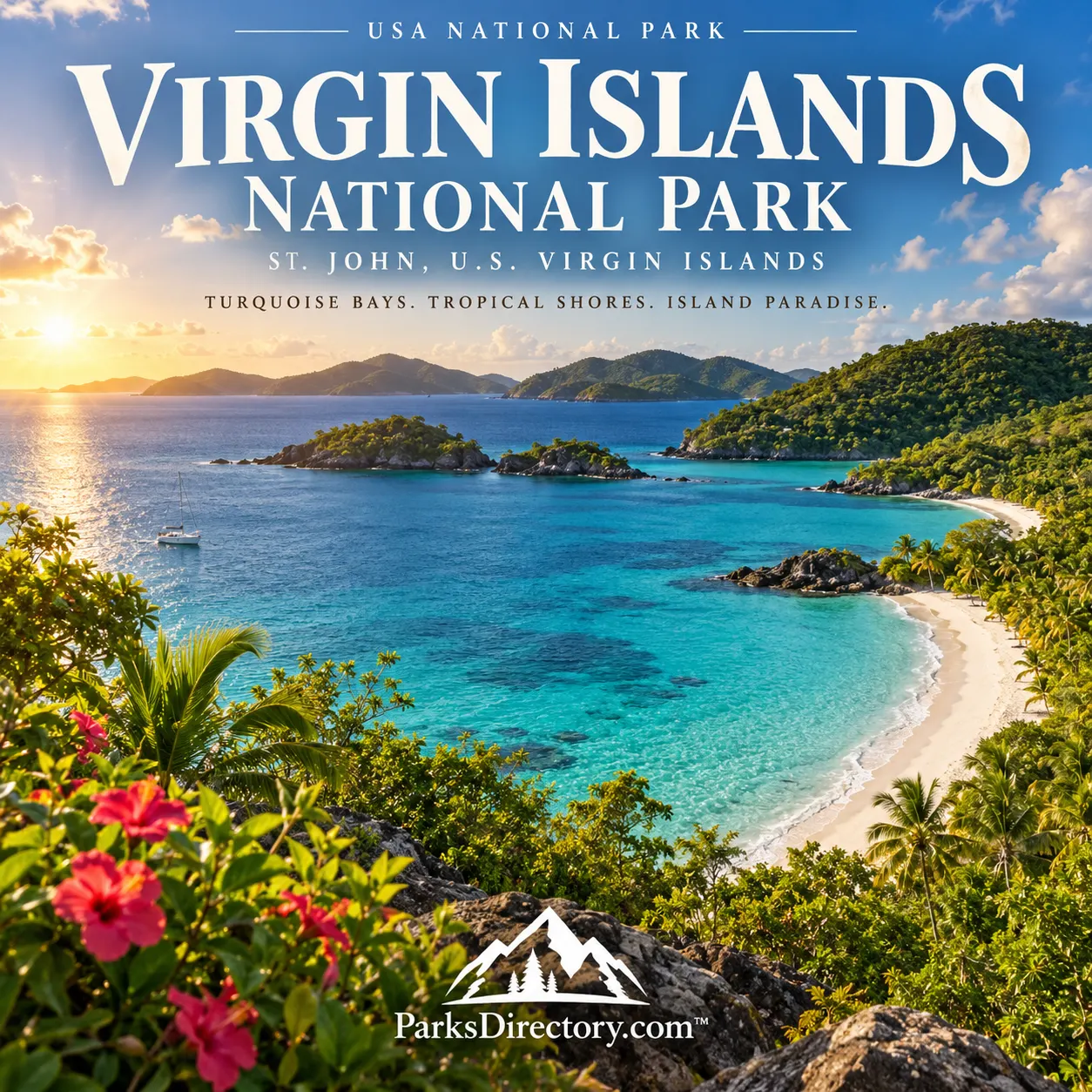
Trunk Bay provides the park’s best-known coastal image: a curving white beach facing blue water and a small offshore cay. Its underwater interpretive trail links that view to the marine world below. Snorkeling reveals that a bay is not an empty blue space; fish, corals, and other organisms occupy a variety of habitats around the shore and reefs.[9]
Other celebrated coastlines include Hawksnest and Cinnamon Bay. Their appeal comes from the meeting of wooded slopes, pale sand, and reef-fringed water, not from a single uniform beach environment. The park’s coastal geography encourages visitors to notice how exposure, shoreline shape, and underwater habitat differ from one bay to the next.[10]
A connected land-and-sea environment
The park protects dry and moist forests, salt ponds, beaches, mangroves, seagrass beds, and coral reefs. St. John is distinctly mountainous rather than flat, with steep hills rising directly above the coast. That relief helps explain why several habitats occur within a relatively compact area and why overlooking the interior gives an incomplete impression of the park.[11]
Beneath the vegetation, volcanic and sedimentary rocks preserve the island’s older geological story. Modern beach deposits and coastal sediments belong to a much younger chapter. The result is a setting where rocky headlands and steep slopes contrast with small pockets of sand and sheltered water.[2:2]
Why this park matters
Virgin Islands National Park’s significance lies in the relationship between its celebrated scenery and difficult, enduring human histories. A beach overlook, a plantation windmill, and a carved rock face ask different questions about the same island. Seeing them together produces a richer understanding than separating “nature” from “history.” Local music, crafts, foodways, and social traditions further remind visitors that island culture continues beyond the boundaries and interpretive signs.[5:1][8:2]
The park’s 1956 creation secured an important place within the American national park system, but its identity is unmistakably Caribbean. Its most notable features reward attention above and below the water, and across both the ancient and recent past.[1:1][2:3]
Sources
Research checked September 6, 2026. Acreage follows the cited NPS atlas and is approximate. Virgin Islands Coral Reef National Monument is not included in the national park total.
National Park Service, “Virgin Islands National Park.” https://www.nps.gov/viis/ ↩︎ ↩︎
National Park Service, “NPS Geodiversity Atlas—Virgin Islands National Park, Virgin Islands.” https://www.nps.gov/articles/nps-geodiversity-atlas-virgin-islands-national-park-virgin-islands.htm ↩︎ ↩︎ ↩︎ ↩︎
National Park Service, “Unique Coral Community in the Mangroves of Hurricane Hole.” https://www.nps.gov/articles/coral-community-in-mangroves.htm ↩︎
Friends of Virgin Islands National Park, “History.” https://friendsvinp.org/history/ ↩︎
National Park Service, “Modern Era.” https://www.nps.gov/viis/learn/historyculture/modern-era.htm ↩︎ ↩︎
National Park Service, “Indigenous Peoples.” https://www.nps.gov/viis/learn/historyculture/indigenous-peoples.htm ↩︎ ↩︎
National Park Service, “African Diaspora in the Virgin Islands.” https://www.nps.gov/viis/learn/historyculture/african-diaspora.htm ↩︎ ↩︎
National Park Service, “Places.” https://www.nps.gov/viis/learn/historyculture/places.htm ↩︎ ↩︎ ↩︎
National Park Service, “National Park Getaway: Virgin Islands National Park.” https://www.nps.gov/articles/getaway-viis.htm ↩︎
National Park Service, “Places To Go” and “Snorkeling.” https://www.nps.gov/viis/planyourvisit/placestogo.htm ; https://www.nps.gov/viis/planyourvisit/snorkeling.htm ↩︎
National Park Service, “Nature & Science.” https://www.nps.gov/viis/learn/nature/index.htm ↩︎