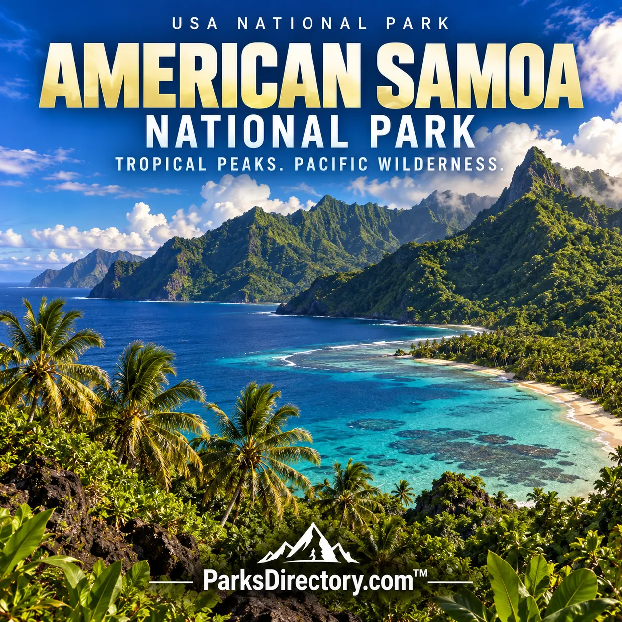
National Park of American Samoa

Pago Pago, American Samoa

National Park of American Samoa

History

National Park of American Samoa: Rainforest, Reefs, and a Partnership with Samoan Communities

ParksDirectory.com™ | National Park Summary & History

Location and the meaning of its boundaries

The National Park of American Samoa lies in the South Pacific, in the U.S. territory of American Samoa. Its principal visitor landscapes are distributed across Tutuila, Ofu, and Taʻū, rather than contained on one island. Pago Pago, named in the supplied park list, is an administrative and travel reference on Tutuila; it is not the location of the entire park. Rainforested volcanic slopes, coastlines, and coral reefs together define this unusually ocean-connected national park.[1]

Its size needs a source-specific explanation. The NPS public fact sheet describes 13,500 acres, including 9,500 land acres and 4,000 marine acres, equivalent to approximately 21.1 square miles. Other NPS inventories describe about 8,257 acres, and the park’s history page refers to more than 8,000. These published figures are not identical. This article uses the public fact sheet’s stated land-and-water total while retaining the discrepancy rather than presenting unlike inventories as a single exact measurement.[1:1][2]

Authorization in 1988, a working agreement in 1993

Congress authorized the park on October 31, 1988, through Public Law 100-571. However, the National Park Service could not simply purchase the traditional communal lands as though they were ordinary private parcels. A 50-year lease agreement signed in 1993 made park management possible through a partnership with the American Samoa Government and participating villages. NPS accounts consequently use both 1988 and 1993 when explaining the park’s creation: the first is the legislative milestone, the second the operational land agreement.[3]

That distinction is fundamental to the park’s character. Protection was developed around continuing Samoan land ownership and community relationships, not around the wholesale replacement of local tenure with federal ownership. Congress approved an additional expansion in 2002. The park’s history therefore involves legislation, leases, and ongoing cooperation, showing that a national park can be organized through a different institutional model from the large federal land reserves familiar on the mainland.[1:2][3:1]

A homeland rather than an empty tropical escape

Samoan culture is not a decorative addition to the scenery. It is one of the park’s central reasons for existence. The Samoan way of life, often expressed as faʻa Samoa, places strong emphasis on family, village relationships, respect, and responsibilities to land and community. Cultural connections reach back thousands of years and continue in contemporary daily life. A historically informed account must therefore describe the park as part of an inhabited cultural landscape, not as an isolated resort setting.[4]

The partnership model makes that principle tangible. Village landowners and leaders remain essential to the way the park is understood and managed. Traditional practices and relationships do not stop at a trail entrance. The national designation protects natural resources alongside archaeological and cultural resources, and it asks visitors to recognize that places can carry meanings not visible in a scenic photograph. This is one of the clearest examples in the national park system of conservation depending on an ongoing relationship with living communities.[4:1]

Volcanic islands shaped by ocean and rainfall

The park’s dramatic relief begins with volcanic origins. These islands rise steeply from the Pacific, and their landscapes have subsequently been shaped by erosion, heavy rainfall, coastal processes, and the growth of reef ecosystems. Mountains, ridges, valleys, and cliffs are connected through relatively short distances. The result is a strong vertical sequence: marine habitats lie close to shoreline vegetation and tropical forest, with wetter conditions and changing plant communities higher on the slopes.[2:1]

This setting helps explain why the park’s land and marine portions cannot be treated as unrelated attractions. Water moving downslope carries the effects of land use toward the coast, while reefs and nearshore habitats interact with the ocean around the islands. The scenery is exceptionally lush, but its ecological value is more specific than tropical beauty alone. It preserves environments with Indo-Pacific biological connections that differ markedly from the forests and marine ecosystems of most mainland U.S. parks.[2:2]

The forests and wildlife that prompted protection

Tropical rainforest is a defining feature, with trees, vines, ferns, and other plants forming layered habitats across steep terrain. The park is especially associated with flying foxes, or fruit bats. These native mammals help connect forest plants through pollination and seed dispersal. Their presence illustrates why preserving an animal can also support the wider structure of a forest, rather than protect only an isolated species that visitors might hope to see.[5]

Birds, coastal wildlife, and marine life add to the park’s biological importance. Coral reefs support complex communities, while the islands’ isolation and limited area make many ecological relationships sensitive to disturbance. Invasive species, severe storms, and changes in ocean conditions can affect resources across large portions of an island. Protection is therefore not just a boundary on a map; it also involves understanding how organisms move, reproduce, and depend on habitats that may be closely connected but physically separated.[5:1]

The places for which the park is best known

On Tutuila, steep forested ridges and the north-coast scenery near Vatia express the park’s mountain-to-sea character. Pola Island and nearby coastal formations are among its recognizable views. Ofu is especially associated with its beach and coral-reef environment, while Taʻū protects substantial rainforest and rugged island landscapes. Together, these districts show why the park should be understood as an archipelago of protected environments rather than a single coastal destination.[6]

Their differences also reveal the limitations of a postcard summary. A reef, a forested ridge, and a village landscape are not interchangeable examples of island scenery. Each represents a different aspect of the park’s purpose and history. For readers studying the national park system, the National Park of American Samoa expands the idea of what a U.S. national park can contain: not only unusual landforms, but a negotiated relationship among ocean ecology, communal landholding, and cultural continuity.[6:1]

The park’s most important legacy is this combined approach. Its rainforest and reefs deserve protection for their ecological significance, but the manner of protection matters too. The 1988 legislation and 1993 lease did not begin the human story of these islands. They added a new conservation framework to a much older homeland, making respect for Samoan communities inseparable from an understanding of the park itself.

Sources

Research checked September 6, 2026. Acreage follows the scope and approximate figures of the cited sources; it is not a current boundary survey. Square-mile conversions are rounded.


  1. National Park Service, Fact Sheet. ↩︎ ↩︎ ↩︎

  2. National Park Service, NPS Geodiversity Atlas: National Park of American Samoa. ↩︎ ↩︎ ↩︎

  3. National Park Service, 25th Anniversary. ↩︎ ↩︎

  4. National Park Service, Management. ↩︎ ↩︎

  5. National Park Service, Nature & Science. ↩︎ ↩︎

  6. National Park Service, History & Culture. ↩︎ ↩︎

Travel guide

National Park of American Samoa: A Guide to Rainforest, Reefs, and Island Culture

ParksDirectory.com™ • USA National Parks Travel Guide

The National Park of American Samoa asks visitors to exchange the familiar national-park road trip for something more patient and personal. Rainforest-covered volcanic slopes descend toward a tropical sea, villages remain central to the experience, and travel between islands requires real planning. This is not a destination to approach as a resort holiday with a park excursion added afterward. Nature, community, and the practical realities of island life belong in the same itinerary.[1]

Pago Pago is a useful starting reference, not an indication that every park landscape lies beside the visitor center. The protected areas are spread across multiple islands, and an itinerary must account for the practical differences between them.[2]

Understand the three-island geography

The park includes sections of Tutuila, Ofu, and Taʻū, protecting rainforest and offshore marine environments. Each island offers a different perspective, and they cannot be treated like districts connected by an ordinary scenic road. Tutuila gives most visitors their first introduction, while reaching the Manuʻa islands adds another layer of transport and accommodation arrangements.[2:1]

Choose the scope of the trip before booking its finer details. A thoughtful stay on Tutuila is preferable to an itinerary that rushes between islands without accounting for limited connections. Travelers hoping to include Ofu or Taʻū should confirm how they will arrive, where they will sleep, and what happens if the return journey changes. Build spare time around onward international travel.

Begin with the visitor center and local advice

The park’s own planning guidance makes clear that facilities differ from those found in many mainland parks. Rather than expecting a sequence of large visitor centers, broad parking lots, and concession complexes, arrive prepared to ask questions and adapt.[1:1]

Start by confirming current trail conditions, available interpretation, transport options, and appropriate conduct in the villages you will visit. Have the names of intended destinations written down, and verify that a proposed journey is practical rather than merely possible on a map. Buy necessary supplies before a remote outing. This early conversation can improve the entire trip, especially for travelers unfamiliar with tropical walking conditions or the relationship between protected land and the surrounding communities.

Discover Tutuila’s forest and coastal views

On Tutuila, the appeal comes from the meeting of steep green terrain and ocean. The park identifies the Vatia area and views toward Pola as highlights; Pola’s dramatic offshore rock supports nesting seabirds. Rainforest walks offer opportunities to observe a landscape very different from the temperate woods of most mainland national parks.[3]

Lower Sauma Ridge and Pola Island Trail offer shorter introductions. Mount ʻAlava Adventure Trail involves ladders and steep ridges, while Tuafanua requires care on slippery terrain; these should not be confused with casual coastal strolls.[4] Carry water, begin without rushing, and allow time to look into the canopy rather than watching only your feet. Binoculars add another dimension to a coastal stop, but wildlife observations should remain quiet and distant.

Consider Ofu and Taʻū as separate chapters

Ofu is associated with coral-sand beaches and offshore reef environments, while Taʻū offers rainforest and striking coastal scenery. The park’s island overview describes Siʻu Point and the dramatic southern coast of Taʻū among its notable landscapes.[2:2][3:1]

These places deserve more than a rushed transfer. Plan the island portion around confirmed local arrangements, including food, drinking water, and the practical limits of transport. Leave enough room for a day when a boat or flight does not operate as expected. Do not interpret a beautiful beach as an automatically safe swimming location. A worthwhile island visit may involve observing the coast from land, learning about village life, or taking a shorter walk rather than pursuing every activity on an ambitious checklist.

Approach the ocean conservatively

Clear water can conceal serious hazards. The park warns about strong currents, tidal outflows, waves, and slippery coastal surfaces. It also advises snorkeling with a partner and avoiding contact with coral.[5]

Before entering the water, ask for current, location-specific guidance. Consider how you will enter and leave, whether the weather is changing, and whether conditions match your actual swimming ability. Neither snorkeling equipment nor enthusiasm substitutes for experience. When the sea is unsuitable, stay ashore and make that decision early.

Protect the reef by maintaining control of fins and equipment, leaving marine life undisturbed, and avoiding standing on coral. A shore-based afternoon is always preferable to a water activity undertaken because the itinerary seems to demand it.

Let climate shape the day

Heat, humidity, heavy rain, and tropical storms affect travel here. The National Park Service identifies a wetter storm-prone period and cautions that heavy rain can produce flooding, landslides, and muddy trails.[5:1]

Build each day around manageable outings with opportunities to rest. Lightweight sun protection, a rain layer, insect protection, and sturdy footwear are more useful than packing for a conventional beach-only holiday. Keep electronics and important documents protected from water. Carry personal medications and other essentials rather than assuming replacements will be readily available on a smaller island. Reassess plans after substantial rainfall, and recognize that a route open yesterday may deserve a fresh conversation today.

Travel as a considerate guest

The experience is rooted in Samoan culture, not just in scenery. Official park material emphasizes the islands’ longstanding cultural history, and visitor guidance calls for modest dress in villages and public settings.[5:2][6]

Ask before photographing people or using community spaces. Seek advice before walking across land where access is unclear, and approach local customs with curiosity rather than assumptions. Beach clothing belongs at an appropriate beach, not automatically in a village. When arranging transport or accommodation, communicate clearly and leave room for the pace of local life.

This approach makes the visit richer. Conversations, food, and the ordinary rhythm of a place can remain as memorable as a viewpoint. Respect is not an extra activity; it is part of how the journey works.

A realistic first-visit framework

For an introductory stay, begin with orientation on Tutuila, then alternate a forest outing with a coastal or village-focused day. Keep one day lightly planned so that weather, local advice, or a newly understood interest can guide it. Travelers adding the Manuʻa islands should expand the trip rather than compress the Tutuila portion into a transfer day.

This is an editorial planning framework, not a transport schedule. Confirm arrangements directly and preserve a buffer before your flight home. The park is most rewarding when it is allowed to be itself: a place of steep rainforest, living reefs, and communities whose home you are privileged to visit. Success is not measured by how quickly you reach all three islands.

Sources

Prepared September 6, 2026. Suggested itineraries are editorial recommendations. Check official park alerts, reservations, and operating information before traveling.


  1. National Park Service, Plan Your Visit. ↩︎ ↩︎

  2. National Park Service, Places to Go. ↩︎ ↩︎ ↩︎

  3. National Park Service, National Park of American Samoa. ↩︎ ↩︎

  4. National Park Service, Hiking. ↩︎

  5. National Park Service, Safety. ↩︎ ↩︎ ↩︎

  6. National Park Service, Tutuila, Taʻu, and Ofu Islands. ↩︎