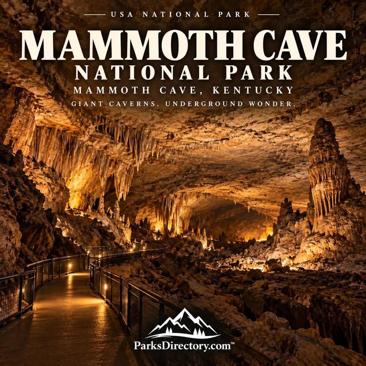
Mammoth Cave National Park: An Underground World with a Remarkable Human History
ParksDirectory.com™ | National Park Summary & History
A national park beneath the landscape
At Mammoth Cave National Park, the most famous scenery is largely hidden. Wooded ridges and the Green River occupy the surface, while an immense network of passageways extends through the limestone below. Located in south-central Kentucky, near communities including Cave City and Brownsville, the park protects an extraordinary underground system together with the land and water that sustain it.[1][2]
The national park covers approximately 52,830 acres, or 83 square miles, according to National Park Service statistics. This surface area should not be confused with cave length: one measures protected land, while the other adds the distances of mapped underground passages. Mammoth Cave is the world’s longest known cave system, with more than 400 miles documented. Exploration continues, so an exact mileage is best understood as a dated survey total rather than a permanent characteristic.[1:1][3]
When Mammoth Cave became a national park
Congress authorized the national park in 1926, but authorization did not immediately create a fully assembled federal property. Land had to be acquired, and the project affected an inhabited rural region of farms, homes, churches, and cemeteries. The Park Service’s historical account describes acquisition involving hundreds of landowners.[4]
Mammoth Cave National Park was established on July 1, 1941. A formal dedication followed in 1946. Distinguishing those events avoids a common confusion between the date Congress approved the idea and the date the park actually came into being. Civilian Conservation Corps work during the 1930s helped prepare roads, trails, and other facilities that supported the emerging park.[1:2][4:1][5]
The conservation achievement had a human cost as residents left land that became federally protected. Forests that visitors now experience as natural scenery can conceal former fields and community spaces. The park’s story is therefore both a national preservation success and a history of local change.[4:2][6]
How water created the cave
Mammoth Cave developed in layers of limestone deposited long before the cave passages existed. Water moving through cracks dissolved the rock, gradually enlarging pathways. Changes in the Green River and the surrounding drainage system influenced the levels at which underground streams traveled, producing passages at different elevations.[2:1]
The relationship between limestone and overlying sandstone is particularly important. A resistant cap helps shield portions of the cave from water entering directly from above. This explains why extensive passages can appear relatively dry and lack the dense stalactites visitors associate with other caves. Mammoth Cave’s defining spectacle is often the scale and continuity of the passages rather than a constant display of hanging formations.[7][8]
Its geology is a lesson in connected landscapes. The ridge above, a sinkhole elsewhere, and a stream emerging near the river may belong to the same underground water system. Protecting the cave requires attention to water quality and land use, not simply the preservation of an entrance.[2:2][9]
The first underground explorers
Indigenous people entered Mammoth Cave thousands of years before commercial tours began. The Park Service describes exploration reaching deep into the system around 5,000 years ago. Surviving evidence includes the traces of people who moved through darkness using the knowledge and materials available to them.[3:1]
This early history overturns the popular idea of an unknown cave awaiting a single modern discoverer. Later explorers greatly expanded mapping and public knowledge, but they were entering a place with an existing human past. Archaeological evidence is especially valuable underground because its location can reveal patterns of movement and activity that written records never preserved.[3:2]
Guides whose skill made Mammoth Cave famous
Nineteenth-century tourism depended heavily on African American guides, including men held in slavery. Stephen Bishop, Mat Bransford, Nick Bransford, and Alfred Croghan helped explore passages and establish routes. Their knowledge gave visitors access to an environment that could otherwise be disorienting and dangerous.[10]
Bishop began guiding in 1838 and produced an important map in 1842. His achievements combined navigation, observation, memory, and the ability to communicate an unfamiliar landscape to others. Accounts that celebrate the cave while overlooking its guides miss people central to the development of its reputation.[5:1]
The Bransford family’s involvement extended across generations. This continuity connects the commercial-tour era with later park interpretation. Their history also requires acknowledging unequal opportunity: expert work and public recognition did not erase enslavement or the discrimination that followed it.[10:1][11]
Tourism, experiments, and competing caves
Mammoth Cave’s nineteenth-century popularity produced hotels, transport services, and increasingly organized tours. A railroad eventually made travel to the cave easier. Remnants of that transportation history help explain how an underground landscape became a nationally known attraction long before it became a national park.[4:3]
Not every use of the cave was successful. In the 1840s, physician John Croghan attempted to treat tuberculosis patients underground, believing the cave environment might be beneficial. The experiment failed. Its surviving historical record illustrates the difference between confident contemporary beliefs and conclusions supported by later experience.[5:2]
Tourism also encouraged competition among cave operators. The national-park project gradually reframed the region from a set of rival attractions into a landscape with shared scientific and conservation importance. That change in perspective is one of the most consequential parts of Mammoth Cave’s modern history.[4:4]
The sights visitors remember
The Historic Entrance is the most recognizable threshold between the wooded surface and the cave below. Inside, different routes reveal broad corridors, tall chambers, narrow connections, and evidence of earlier exploration. No single tour represents the entire system, and the impression of scale develops through understanding how the passages connect.[8:1][12]
Frozen Niagara provides a contrasting setting, celebrated for deposited mineral formations. Flowstone, stalactites, stalagmites, and other features develop where water conditions permit them. Their presence does not contradict the relatively dry appearance of many other passages; it demonstrates how conditions vary within one enormous cave system.[13]
Above ground, the Green River, woodland trails, springs, and historic cemeteries complete the park’s identity. The emergence of underground water into daylight is especially revealing. It makes the connection between the cave and surface landscape visible, turning a walk beside a spring into a continuation of the underground story.[9:1][12:1]
Why Mammoth Cave matters
Mammoth Cave is best known for its extraordinary length, but its importance cannot be reduced to a record. It preserves evidence of ancient environments, living ecosystems, Indigenous exploration, African American expertise, rural communities, and the growth of American tourism. The national park protects a system of relationships as much as an underground monument.[2:3][3:3][10:2]
For a visitor, the most rewarding approach is to connect those layers. A cave chamber becomes more meaningful when considered alongside the water that formed it and the people who learned to navigate it. That combination makes Mammoth Cave one of the country’s most distinctive places to encounter natural and human history together.
Sources
Research reviewed September 6, 2026. Acreage follows NPS statistics; square miles are rounded. Cave length is deliberately stated as more than 400 miles because surveyed totals change. Authorization, establishment, and dedication are distinguished.
National Park Service, “Park Statistics.” https://www.nps.gov/maca/learn/management/statistics.htm ↩︎ ↩︎ ↩︎
National Park Service, “NPS Geodiversity Atlas—Mammoth Cave National Park, Kentucky.” https://www.nps.gov/articles/nps-geodiversity-atlas-mammoth-cave-national-park-kentucky.htm ↩︎ ↩︎ ↩︎ ↩︎
National Park Service, “Exploring the World’s Longest Known Cave.” https://www.nps.gov/articles/000/exploring-the-worlds-longest-known-cave.htm ↩︎ ↩︎ ↩︎ ↩︎
National Park Service, “Kentucky: Mammoth Cave National Park.” https://www.nps.gov/articles/mammothcave.htm ↩︎ ↩︎ ↩︎ ↩︎ ↩︎
National Park Service, “Timeline.” https://www.nps.gov/maca/learn/historyculture/timeline.htm ↩︎ ↩︎ ↩︎
National Park Service, “Forests.” https://www.nps.gov/maca/learn/nature/forests.htm ↩︎
National Park Service, “Rocks of Mammoth Cave.” https://www.nps.gov/maca/learn/nature/rocks-of-mammoth-cave.htm ↩︎
National Park Service, “Audio Tour of Mammoth Cave.” https://www.nps.gov/maca/planyourvisit/audio-tour.htm ↩︎ ↩︎
National Park Service, “Ecosystems.” https://www.nps.gov/maca/learn/nature/ecosystems.htm ↩︎ ↩︎
National Park Service, “African American History.” https://www.nps.gov/maca/learn/historyculture/african-american-history.htm ↩︎ ↩︎ ↩︎
National Park Service, “Black History Month Programs at Mammoth Cave National Park.” https://www.nps.gov/maca/learn/news/black-history-month-programs-at-mammoth-cave-national-park.htm ↩︎
National Park Service, “Mammoth Cave Map & Guide.” https://www.nps.gov/maca/planyourvisit/mammoth-cave-map-guide.htm ↩︎ ↩︎
National Park Service, “Stalactites, Stalagmites, and Cave Formations.” https://www.nps.gov/maca/learn/nature/stalactites-stalagmites-and-cave-formations.htm ↩︎