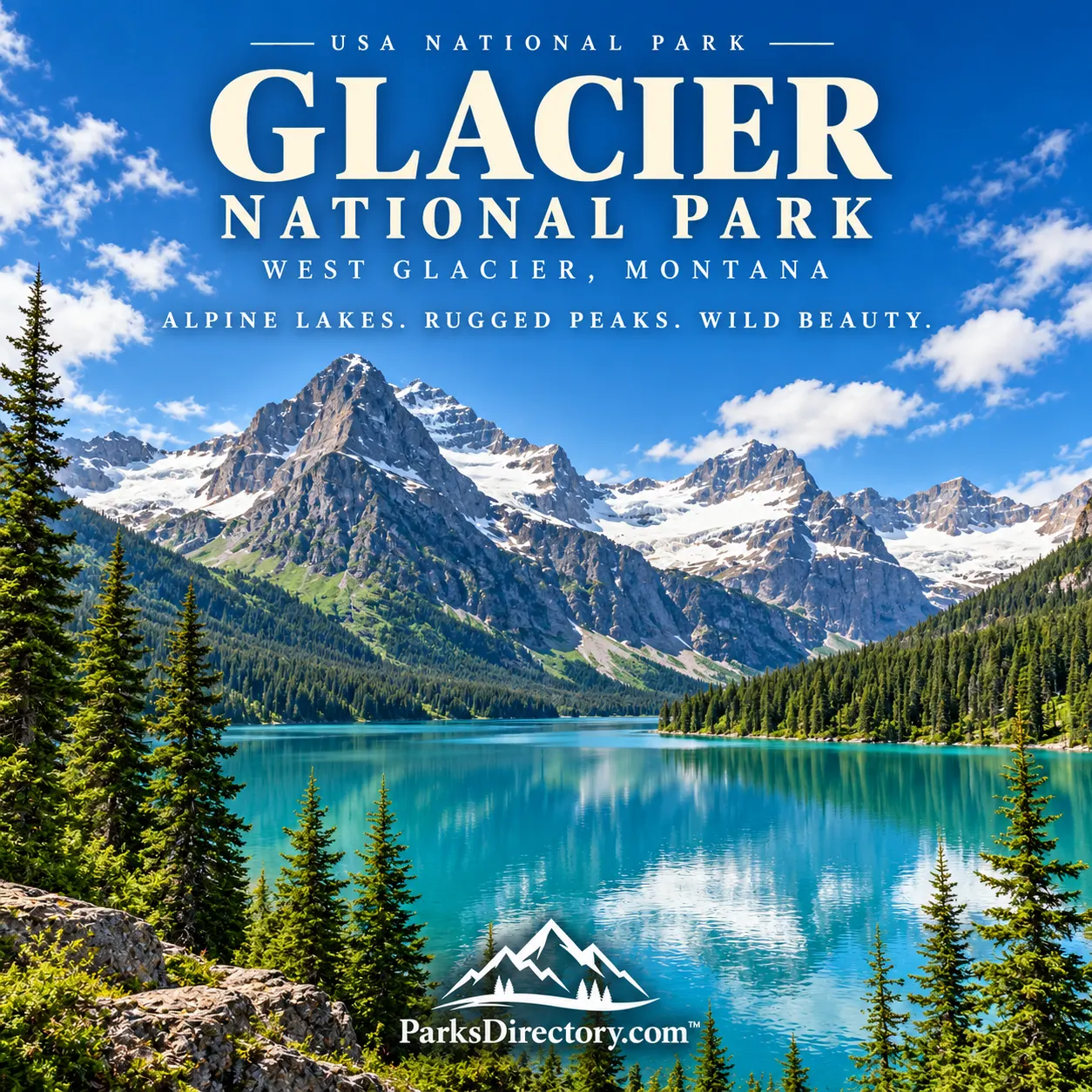
Glacier National Park: Mountain Scenery, Indigenous Homelands, and an International Legacy
ParksDirectory.com™ | National Park Summary & History
Location, size, and establishment
Glacier National Park occupies the northern Rocky Mountains of northwestern Montana, along the international boundary with Canada. West Glacier is a principal gateway on the park’s western side, while the Blackfeet Reservation adjoins its eastern boundary. The NPS park fact sheet reports 1,012,837 acres, or approximately 1,583 square miles. This figure refers to the United States national park, not the additional area of neighboring Waterton Lakes National Park in Canada.[1][2]
President William Howard Taft signed the legislation establishing Glacier on May 11, 1910. In 1932, Glacier and Waterton Lakes became the Waterton-Glacier International Peace Park. The two parks remain separately administered; the international designation recognizes a shared landscape and the value of cooperation across a political boundary.[1:1]
Glacier is celebrated for steep mountain walls, long lakes, waterfalls, alpine meadows, and surviving glaciers. Its name captures one important part of its identity, but its history and scenery are far broader than the ice that remains on its slopes.
A mountain homeland before 1910
People used the Glacier region long before the national park was established. The Blackfeet, Salish, Pend d’Oreille, and Kootenai have enduring connections to these mountains and valleys. Hunting, travel, trade, and spiritual relationships linked country on different sides of the Continental Divide. A modern park boundary cannot describe the full extent of those connections.[3]
Nineteenth-century expansion altered this geography profoundly. Tribal communities faced pressure, displacement, and confinement to reservations. An 1895 agreement transferred mountain lands east of the Continental Divide from the Blackfeet to the federal government under circumstances shaped by mining interests. The resulting history is important to understanding how an area described nationally as scenic public land was already a homeland with existing rights and meanings.[2:1]
The mountains did not become culturally significant when they appeared on tourist posters. Tribal relationships with places such as the eastern valleys and mountain passes continued through, and after, the creation of the park. Contemporary interpretation increasingly places those histories beside the better-known accounts of railway promoters and conservation advocates.[3:1]
Railways, conservation, and the national park idea
The arrival of the Great Northern Railway transformed access to the region. Its route over Marias Pass was completed in 1891, enabling greater settlement and eventually bringing more visitors into mountain country. Early tourism depended on combinations of rail travel, stagecoach journeys, boats, horses, and trails rather than a continuous road across the park.[2:2]
George Bird Grinnell became one of the area’s most influential conservation advocates. His visits, writing, and campaigning helped build support for national-park protection. Louis Hill of the Great Northern Railway also played an important role. Conservation and commercial tourism were not entirely separate forces: preserving spectacular scenery could also encourage travelers to buy railway tickets and stay in mountain hotels.[4]
After the park’s establishment, lodges, chalets, and other visitor facilities helped define its public image. The Going-to-the-Sun Road eventually made an east-to-west mountain crossing possible by automobile. These developments created the familiar tension between access and preservation: engineering and hospitality opened the landscape to wider appreciation, while roads and buildings necessarily changed parts of it.[1:2][2:3]
How the mountains acquired their appearance
Glacier’s dramatic relief results from several different geological processes working across immense spans of time. Ancient sedimentary rocks record environments that existed long before today’s mountains. Mountain building and fault movement rearranged those layers, while later glaciers excavated valleys and basins. The result is a landscape in which geological structure and glacial erosion are both plainly visible.[5]
The broad U-shaped valleys, steep headwalls, hanging valleys, and lake-filled depressions are especially characteristic. Waterfalls often descend where smaller tributary valleys meet deeper main valleys. Long lakes occupy basins carved or modified by ice. These features explain why the park retains a strongly glacial appearance even where no modern glacier is visible.[5:1]
The glaciers that survive today are changing. The National Park Service documents widespread retreat and shrinking ice, making Glacier an important place for observing environmental change. A fixed glacier count or a promised disappearance date can be misleading because measurements depend on definitions and conditions. The enduring geological story is the distinction between the major ice-age processes that shaped the terrain and the smaller glaciers that remain within it.[6]
The places for which Glacier is best known
Lake McDonald is the park’s largest lake and one of its signature western landscapes. Forested shorelines and mountain reflections provide a different impression from the exposed terrain near the Continental Divide. The surrounding valley also preserves layers of tourism history, reminding visitors that this seemingly natural view has long been a destination for travelers.[1:3][7]
Logan Pass and the Going-to-the-Sun Road offer the park’s best-known encounter with high-elevation scenery. The road climbs through a succession of landscapes rather than simply connecting two entrances. Rock walls, alpine vegetation, waterfalls, and distant peaks help reveal how quickly conditions change with elevation and exposure.[7:1]
On the eastern side, St. Mary, Many Glacier, and Two Medicine are associated with mountain lakes, sharply defined ridges, and trail networks leading toward higher basins. They are distinct landscapes, not interchangeable viewpoints. Many Glacier is particularly associated with the relationship between lakes, glacial landforms, and historic lodging, while Two Medicine carries especially important cultural and early-tourism associations.[7:2]
The less-developed North Fork country broadens the picture again. Glacier’s identity includes quiet forest-and-lake landscapes as well as its famous paved crossing. Appreciating that variety helps explain why its protected area extends across more than a million acres rather than enclosing only the most photographed mountain views.[7:3]
Wildlife, watersheds, and international significance
Glacier stands at the headwaters of major drainage systems and contains contrasting climatic influences. Those circumstances contribute to its ecological diversity. Forests, wetlands, meadows, streams, and alpine habitats support animals ranging from small cold-water organisms to mountain goats and large carnivores. Their conservation depends on habitat connections extending beyond the boundaries of individual scenic areas.[6:1]
The international peace-park designation gives that ecological continuity a political expression. A bear, river, weather system, or mountain ridge does not stop at the United States–Canada line. Cooperation between Glacier and Waterton therefore reflects something already true of the physical landscape.[1:4][6:2]
Glacier’s history can be read through several overlapping frames: an Indigenous homeland, a conservation achievement, a railway-era destination, a landmark of road engineering, and a living record of environmental change. Its most celebrated views are the beginning of that story. The deeper significance lies in understanding how those histories meet within the same mountains.
Sources
Research checked September 6, 2026. Acreage follows the NPS park fact sheet, updated August 12, 2024; it is not represented as a new boundary survey. Descriptions of places do not imply current road or trail access.
National Park Service, Glacier National Park Fact Sheet. ↩︎ ↩︎ ↩︎ ↩︎ ↩︎
National Park Service, Park Information. ↩︎ ↩︎ ↩︎ ↩︎
National Park Service, History & Culture. ↩︎ ↩︎
National Park Service, Nature & Science. ↩︎ ↩︎ ↩︎
National Park Service, Places To Go. ↩︎ ↩︎ ↩︎ ↩︎